The Zunoquad

Zunoquad Squad Cycles the Kettle Valley Railroad Trail (4)

Friday, June 6th, 2008

May 24

After two days of rain and overcast, the morning broke with sun over the lake. Steven went for a cold water swim and shave. Ian received a phone message that Rob was feeling better and would spend time touring the Kootenays by car before rejoining us back in Princeton.

Puddles on the trail deepened, but after Murray endured one wet spill we learned that in low gear bikes are navigable in water. At Summit Lake the uphill grade (never more than 1.9% on the long ascent) levels and we looked forward to the predicted grand scenery of Myra Canyon. Steven was pedaling as happily as a five year old on his first bike, when suddenly his left pedal and crank fell off and landed in the sand. He yelled in protest at this new reverse. The crew gathered round, and Ian, our official bike mechanic”he’d been a fisherman for 7 years”looked for the correct Allen wrench in the kit provided with the bike to tighten the bolt that had fallen out and released the crank. It was missing. The pliers of a Leatherman served as a provisional substitute to tighten the dropped bolt and those on Peter’s bike which had also loosened.

(more…)

Zunoquad Squad Cycles the Kettle Valley Railroad Trail (5)

Friday, June 6th, 2008

May 25

John left on his mission early.

The diminished band of six packed leisurely and pedaled through the parking lot at the approach to Myra Canyon. At the end of curved cut in the rock a vast panorama unfolded. A huge gulf dropping to Lake level was scooped out of the high plateau to which we’d ascended for three days. A dozen or so side canyons covered with the charred remains of a burnt forest and numberless rockslides, opened into it. At the top of the canyon rose a single, wide, snow-covered peak. Volcanic eruption, landslide, holocaust: a display of nature’s power, demonic and sublime.

Next into view came a fine level line threading its way from where we stood, in and out of the side canyons, heading off towards the snowy summit and then back toward us on the other side of the abyss, supported across gaps narrow and wide by a delicate latticework of trestles.

After a lengthy stop to gaze, we crossed the first trestle on a surface of new planking that produced a clean hum from the tires.

It was a smooth thrill of a ride, created by a double human triumph over nature. The first was the original construction of the railroad, motivated by the desire to extract her wealth. The second was the recent reconstruction of the trail and trestles after decay and fire, motivated by the desire to provide pleasure to visitors. As we stopped again at the end of the first trestle, two kids and their parents on bikes came up behind us. “It’s just like Disneyland,” said one.

(more…)

Zunoquad Squad Cycles the Kettle Valley Railroad Trail (6)

Friday, June 6th, 2008

May 26

The morning remained rainy and foggy, the prospect of more pie and pool playing and of getting a tour of Doreen’s husband Gary’s museum made most of us want to lay over for a day, but Behr was eager to return to Vancouver and look after his mother. After extensive discussion a vote was taken and Behr decided to head back on his own. Murray didnt like the idea.

The remaining crew of five agreed to rent one of Doreen’s cabins, a log house fitted out with beds, kitchen, bathroom, and red curtains, none of which was unappealing after four nights in tents. Steven and Murray dove into the cold lake. Doreen joined us for Murray’s morning Pome reading.

Gary reminisced about his history as a lineman and union official during the violent conflicts with BC Hydro in the ˜50’s and then led us through his extensive museum of local antiquities, including his locked collection of electric line insulators, one of which he had sold for $11,000. Among thousands of intriguing items was a portent of the future: an electric lamp whose current flowed through a meter informing the user of real time energy cost.

(more…)

Zunoquad Squad Cycles the Kettle Valley Railroad Trail (7)

Friday, June 6th, 2008

May 27

Chute Lake’s placid surface mirrored clear skies on Tuesday morning. Behr and Robert drove off and the five men remaining headed down the trail whose surface was hard packed after days of rain. For the whole of the 30 km descent the slope remained steeper than anywhere on the ascent, increasing speed and ease of pedaling. Bleak burnt and logged-over landscape gave way to mature second growth forest carpeted with grass and wildflowers. A rushing stream crisscrossed the trail.

We stopped to explore Rock Ovens in the woods built to bake bread for the railroad work crews. The nurses whizzed past shouting instructions for us to bake bread for them. Lionel replied that their place was in the kitchen. Flush with downhill speed, we overtook the women slowed by their bike trailers, and stopped at an opening in the forest cover to take pictures of the sand cliffs, endlessly stretching lake, orchards, vineyards and small settlements in the Okanagon valley below. As soon as Andy broke out three beers remaining from yesterday, the nurses came barreling down behind us and screetched to a halt when we held out the bottles. After a shared toast, they passed around a mickey of powerful cinnamon liqueur, and we agreed to meet for lunch at a vineyard once we reached Naramata.

(more…)

Hiking the Nootka Trail (1)

Friday, September 4th, 2009

Prelude

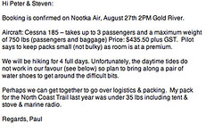
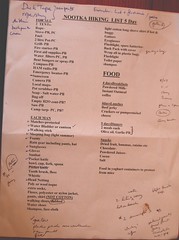
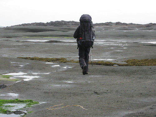
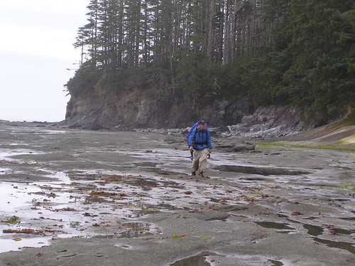
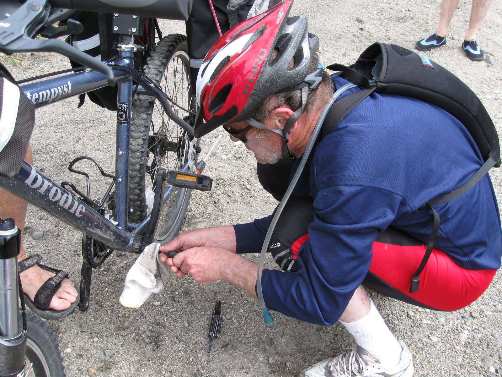
Peter B. had proposed a backpacking trip between the time Jan left B.C. for California and before our trip to the Yukon.  He invited his hiking buddy Paul C. to join us on the West Coast Trail from Tofino to Bamfield, but there were no reservations available for that heavily traveled route, so he suggested we do the Nootka Trail, a less known but comparably grand and remote wilderness experience. I agreed, as usual, to follow his lead, and he and Paul together did the research and made the necessary preparations, including getting plane and boat reservations, trailguides and maps.  After it took me almost a full day just to shop for my own provisions and pack for a six-day expedition, I felt grateful for all their legwork.

flightreserv.jpg

IMG_8193.JPG

August 27  South of Third Beach

nootkamap1.jpg

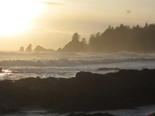
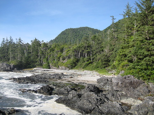
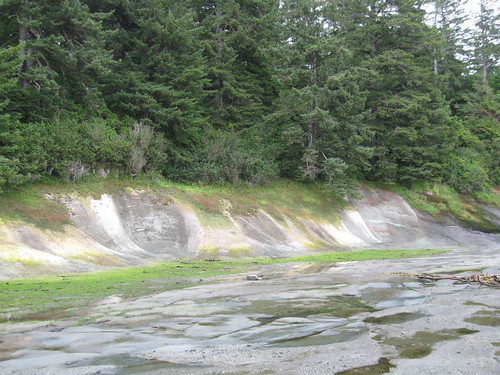
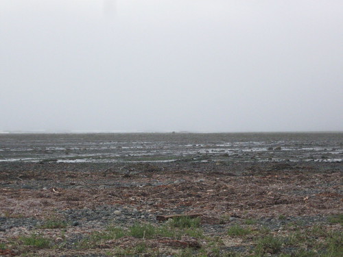
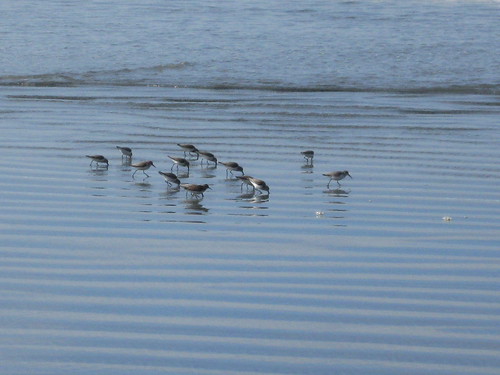
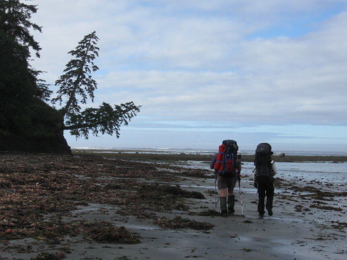
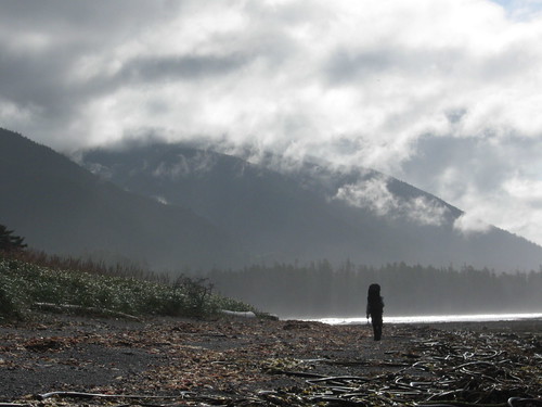
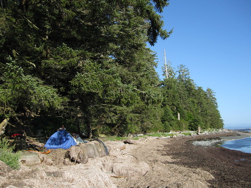
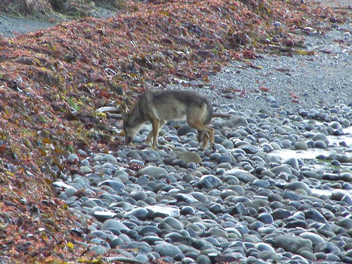
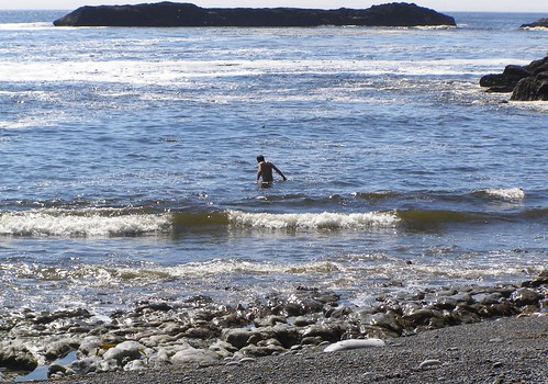
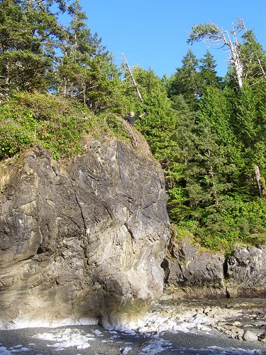
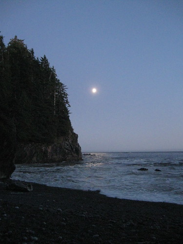
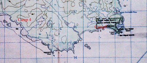
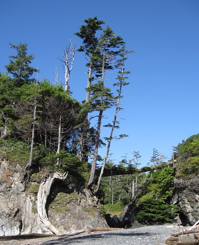
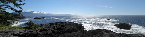
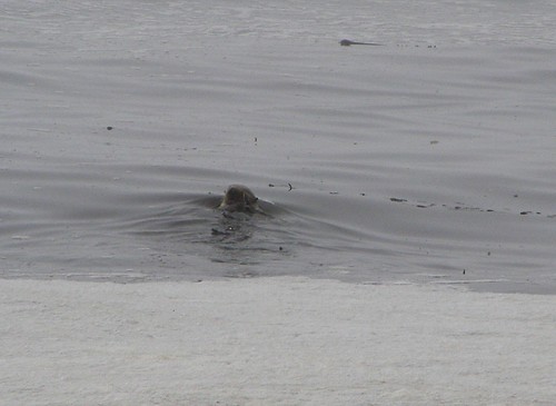
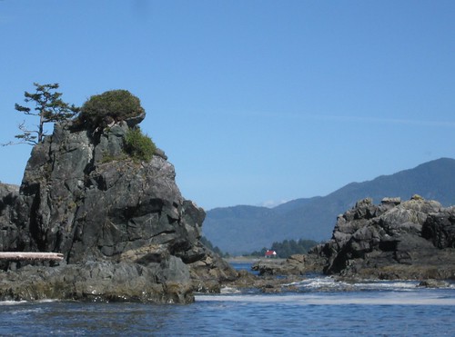
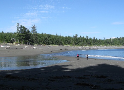
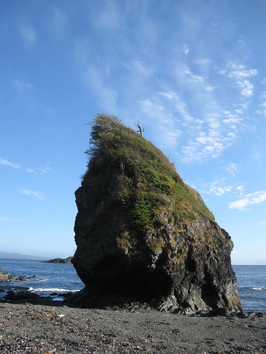
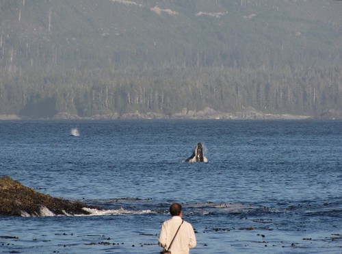
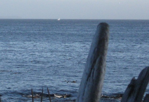
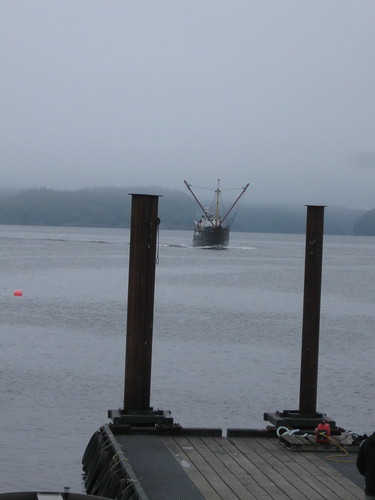
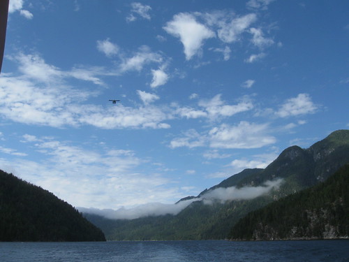
The sun drops into a rising fog bank above distinctive trapezoidal rocks and a tree-topped headland. The waves’ roar has been unabated since I first heard it deep in the forest on the trail from Louis Lagoon.  White tips are painted on the crests of broken rollers. The thunder of water colliding with stone vibrates in my gut. Thick foam left by turbulence and mashed red-tide algae accumulates on the beach. This is wilderness West Coast.  Nothing but the tiny settlement of Friendly Cove until Tofino, 75 miles to the south and only small towns fifty miles back up the inlets where the mills used to churn.  But before contact with Europeans in the late 18th century, this seacoast was home to hundreds of thousands of people for five thousand years.

IMG_2975.JPG

IMG_2957.JPG

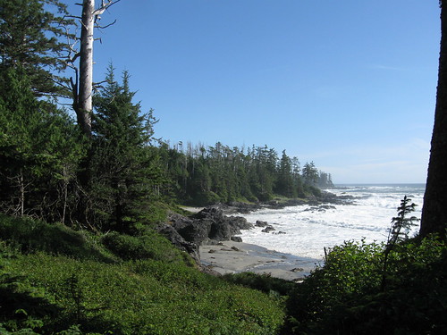
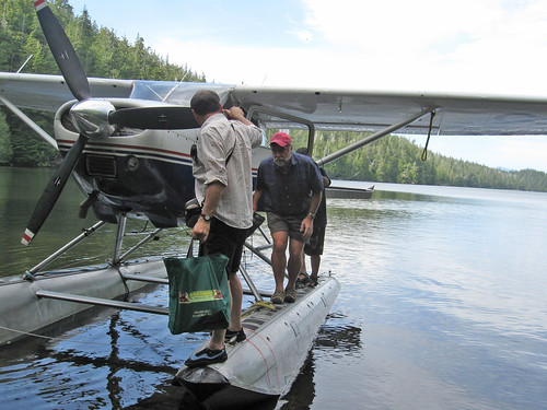
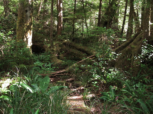
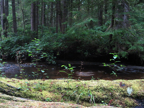
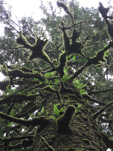
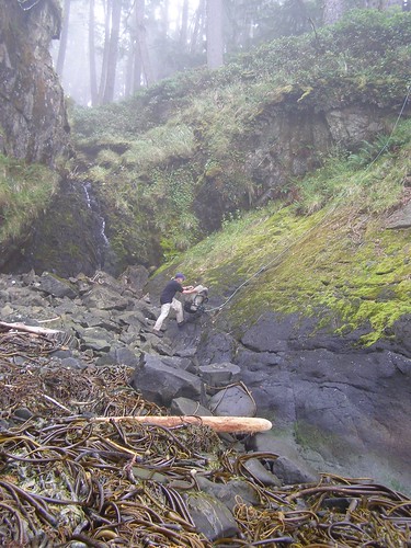
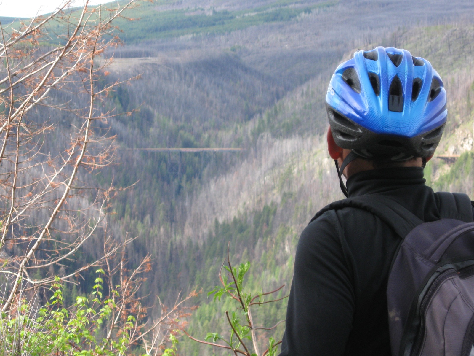
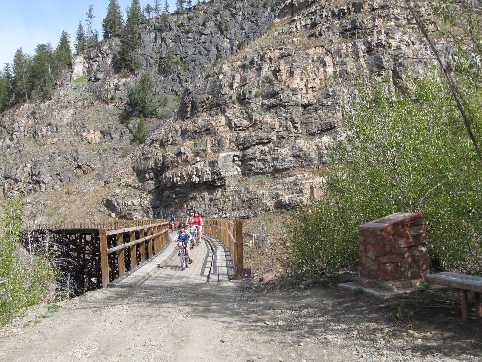
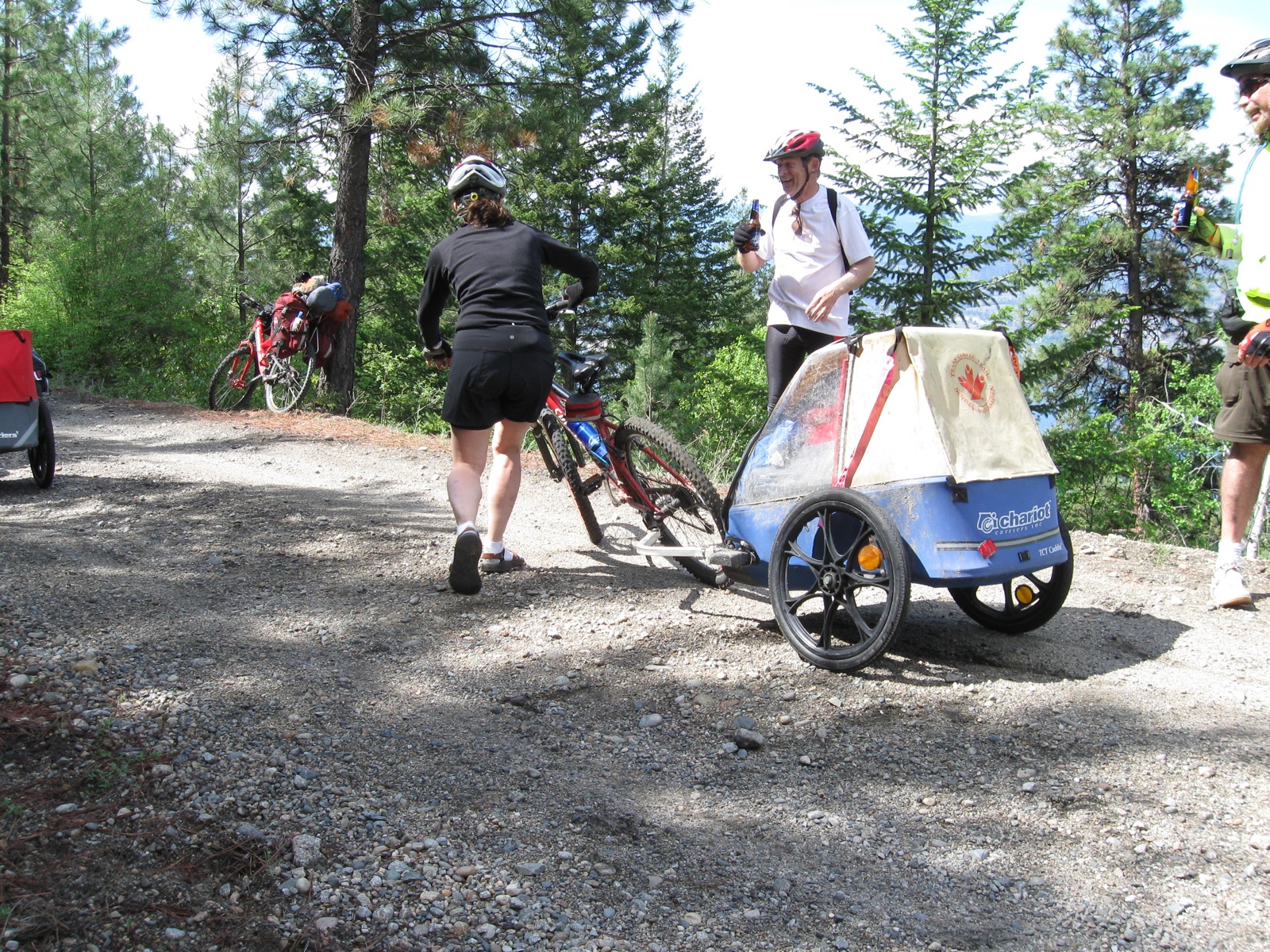
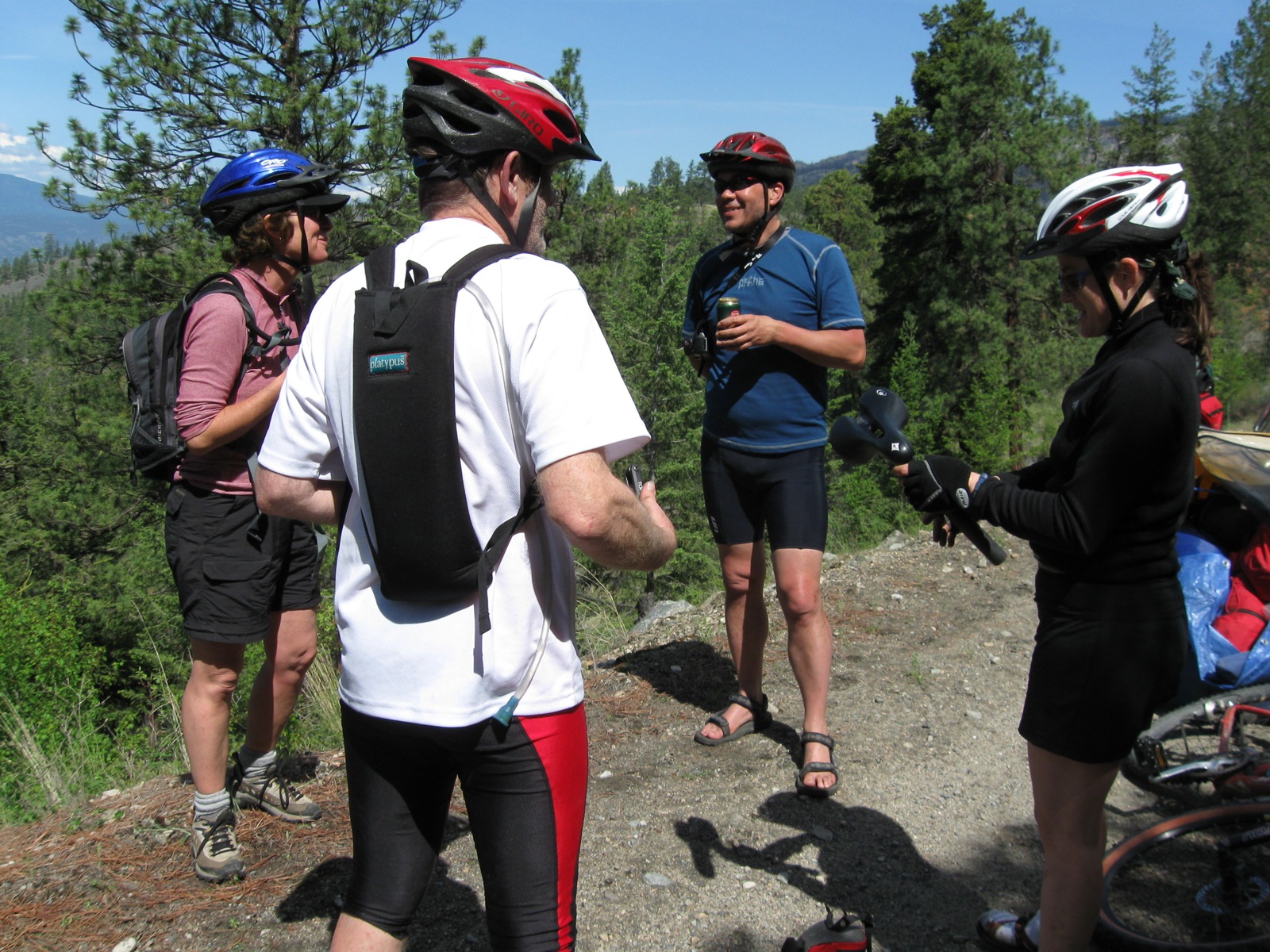
We were conveyed here by ferry across the Georgia Strait from Powell River, by Subaru to Gold River, by Nootka Air Seaplane to the Lagoon and by our feet across an isthmus of old growth cedar, hemlock and spruce on a rough trail cut and maintained by volunteers.  It winds through tangles of roots and windfalls obscuring the borders between ground and growth, living and dying. Immense trees, leaning and erect, sprout from fallen nurslings and grizzled snags to reach for sky.  Underfoot, ferns and bunchberry capture spots of sunlight that penetrate the dark canopy.

IMG_2921.JPG

tallcedartilt.jpg

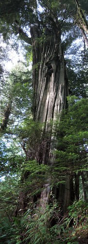
I walked at a slug’s pace to balance the weight of the pack and spare my knees, and also to gaze at a living world hardly disturbed by humans.  It feeds, aspires, grows, strengthens, procreates, cooperates and competes, weakens and dies as we do, at a different temporal scale and speed.

IMG_2930.JPG

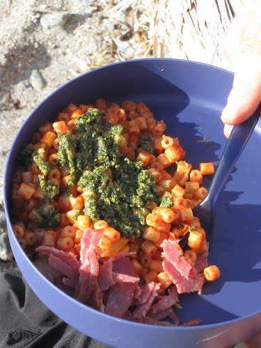
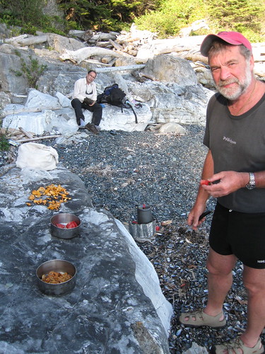
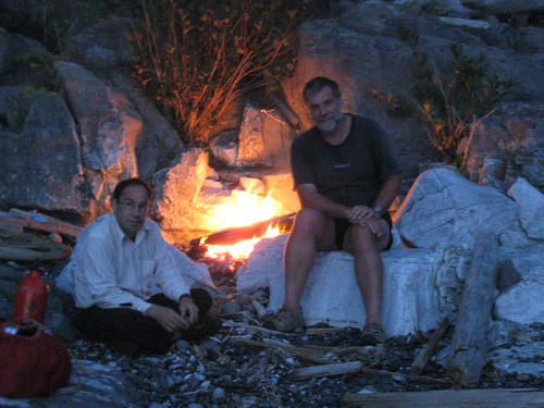
We found this campsite not indicated in the guidebook. It provides water to try out Peter’s fancy ozone generating purifier kit, which no one likes.  After an aperitif of whiskey from the plastic bottle, we were excited to share our first dinner: sautéed garlic and onion, tiny pasta rings, tomato sauce, fresh pesto I bought from Pat Hanson, and a little bit of sliced cervelatwurst, a guilty pleasure on my cholesterol-free diet.

IMG_2965.JPG

IMG_2972.JPG

For a full set of images and slideshow for this day, go here

Hiking the Nootka Trail (2) »

Hiking the Nootka Trail (2)

Friday, September 4th, 2009

August 28 Skuna  Bay

nootkamap3.jpg

Yesterday’s blasting surf settled to a smooth rush from far offshore across the tidal shelf.  The quiet creek winds through first-growth spruce forest, clear enough for me to explore in my water shoes after the regular post-hike nap.  Many of the spruces are snapped off with a horizontal break at 50, 100 or 200 feet and surrounded by light coming through the hole their fallen tops leave in the canopy.

IMG_3016.JPG

IMG_3012.JPG

Contrasting to the noise and motion of sea and sky, the creek walk prompted reflection on the unpeopled landscape we’ve been immersed in now for more than 24 hours: the margin of land and ocean varying from forest and rock outcrop to beaches of sand, boulders, pebbles and vast sandstone shelves.

IMG_2987.JPG

IMG_2996.JPG

I wore parka, rainpants and poncho to stay dry through the swamps, fog and drizzle that succeeded the sunshine of our first day. My pants kept slipping down and my glasses kept fogging up from the heat of exertion, especially during the half hour we found ourselves bush-crashing to recover the lost trail.  The weight I’d added to my pack to reduce Peter’s tortured my shoulders until Paul showed me the proper strap adjustment to bring it closer to my back.

P8270416.JPG

The series of headlands requiring diversions through the bush ended and the beach turned into a flat tidal shelf of sandstone with good traction extending for a mile seaward and disappearing into the fog.

IMG_3026.JPG

Drifting off to nap after the day’s six-hour trek, I counted primal contraries revived by backpacking: wet-dry, hot-cool, cold-warm, hungry-full, thirsty-slaked, tired-rested, anxious-relieved. Now my boots, soaked in the last creek crossing, have dried and warmed by the fire.

Peter provided dinner of Annie’s organic Mac and Cheese, my grandsons’ favorite.

Hiking the Nootka Trail (3) »

For a full set of images and slideshow for this day, go here

Hiking the Nootka Trail (3)

Friday, September 4th, 2009

August 29  Midway between Bajo Point and Bajo Creek

nootkamap3.jpg

This morning dawned foggy.  Paul had coffee already brewed on his stove as I crawled out of the tent, less stiff and achy than on previous days. Walking on the hard grey sand along the smooth curve of Skuna Bay was fast and fluent.  We were greeted by a flock of killdeer at a little creek’s descent into the ocean.  A distinct track preceded us, which Paul identified as wolf.  For a while it was joined by bear prints and the delicate tracks of killdeer and sanderlings which follow the water’s moving edge, a double oscillation of waves within tides.

IMG_3069.JPG

IMG_3066.JPG

P8280489.JPG

IMG_3063.JPG

As we rounded the point at the south end of Skuna Bay under an awning of horizontal spruces, the sky disrobed, revealing its naked blue splendor and the sun’s brilliance. The top end of the bay where we’d camped remained in clear view, but continued shrinking into the expanding landscape.  Three days now with no trace of other humans”no logged stumps or springboard notches, no boats or planes or even contrails”except for a sprinkling of detritus on the beach: mostly water bottles and net floats.

IMG_3044.JPG

IMG_3062.JPG

Calvin Falls came into view, a white cascade of fresh water pouring into a deep pool with a slow circular current that empties into an ocean-seeking stream flowing across the wide beach. I welcomed the chance to get out of my wet boots and take a cleansing swim before lunch.  As we continued on, the friendly packed sand was replaced by large polished boulders, at first difficult to negotiate but soon allowing light-footed progress guided by close attention to the steps immediately ahead, enhanced by the stones’ artful variety of texture and color.  Then the boulders got covered with thick deposits of seaweed and eelgrass ripped by storms from kelp beds offshore. We either had to slog through the soft wet piles or balance our way along the driftwood stacked at high tide line. At first the stench was overwhelming but after an hour or so, one got used to it.

IMG_3074.JPG

IMG_3095.JPG

We found a fresh water rivulet and nearby a tent site on a soft bed of rotten eelgrass behind a thin barrier of logs that separated us from mountains of broken bull kelp, giant kelp and other algae that would provide a fortune in sushi, fertilizer and xanthan gum to anyone who could harvest it. After a nap Peter and I headed up into the bush to reconnoiter, drawn by sky visible above the treetops. We tunneled through salal up to a bench where it thins to allow relatively easy walking among widely-spaced first-growth trees and windfalls. We made for a huge gnarled cedar and found around its back traces of removal of cedar planks by native inhabitants long ago. Such “Culturally Altered Trees” provide evidence in present-day land-claims negotiation. We wandered further back along the trunk of a windfall hung up in the crossing of a cedar and a spruce and ended up fifty feet above the forest floor in the middle of the clearing it created.  Peter’s foot dropped through a hole in the moss, but he didn’t fall.  We bushwhacked toward the little creek leading to our campsite on the beach and crossed on a windfall leading to another old-growth cedar with a bear’s lair in its hollow base.  When we returned to camp, we found Paul napping instead of cooking. After a rude awakening he cooked up a much-anticipated meal of jambalaya and sockeye salmon with chocolate pudding for dessert. The incoming tide nudged piles of seaweed into gracefully curved windrows along the shore.

IMG_3147.JPG

IMG_3127.JPG

IMG_3158.JPG

I got up to pee at 1:00 A.M. and was shocked by a bright orange moon sinking behind the shelf it exposed by pulling out the tide.

Hiking the Nootka Trail (4) »

For a full photoset and slideshow of this day’s sights, go here

Hiking the Nootka Trail (4)

Friday, September 4th, 2009

August 30   Marble Cove

nootkamap4.jpg

As we loaded our backpacks in the morning, Peter called out “the Wolf !” I looked up, and there it was, fifteen feet away on the other side of the log.  My camera, which I usually carry on my belt, wasn’t working because of a battery malfunction, and I yelled, “get the cameras.” As Peter and Paul scrambled for theirs, the creature stopped and I got my first look at a wolf in the wild.  Rather than the fierce and proud appearance I expected, it seemed hangdog and scrawny, but nevertheless surprisingly large. Its ribs protruded and its face, as it turned toward us, was flat and small-eyed, its legs long, its tail down.  As they snapped pictures, the wolf ambled over to a pile of bull kelp, nosed it disconsolately, stared up at us with an expression of hopeless hunger and moved on.  It recalled the wolf in illustrations of Little Red Riding Hood.

P8280477.JPG

P8280483.JPG

We hiked around the next point and passed a couple of cabins on the bluff above Beano Creek, which our both our trailguide and the pilot had mentioned were not to be disturbed and which were at the end of a logging road that could, before long, allow the trucks into this still unprotected section of the coast to destroy the forests we marveled at. We followed some flagging we thought indicated the trail around the impassable headland ahead up into the bush and ended up behind one of the cabins.  An elderly gentleman yelled across a logged-over patch that we were on the wrong trail and that we should take the bypass further down the beach.  Paul thanked him and then found a ripe red tomato unaccountably left in the middle of the trail. We welcomed it as compensation for our first unsavory reencounter with civilization. An added infusion of fresh produce materialized along one of the arduous bypass trails–a large colony of chanterelles, which Paul and Peter pounced on with expressions of glee.

P8280495.JPG

P8280502.JPG

For several hours, the trail alternated between steep headland traverses through old-growth cedar groves and beautiful pocket beaches, including a sighting of a contented looking Pacific otter, the species rendered almost extinct by the fur trade between Indians and Englishmen during the 19th century.  We felt ready to stop at a small cove protected by limestone and marble walls and tall spruce-covered headlands. I climbed a tiny treed promontory that rose from the middle of the beach and Peter and I explored a sea cave at the north end. While Paul set up camp and gathered firewood, Peter took a swim in the rocky surf. I got wet and then lay down and buried myself in warm smooth beach pebbles. Then I cooked dinner of couscous and tuna while Paul sautéed the chanterelles with a garnish of tomato. Sunset and fire rounded off the evening.

P8290520.JPG

P8290541.JPG

IMG_3164.JPG

IMG_3180.JPG

IMG_3181.JPG

Hiking the Nootka Trail (5) »

For a full photoset and slideshow of this day’s sights, go here

Hiking the Nootka Trail (5)

Friday, September 4th, 2009

August 31  Yuquot

nootkamap_2.jpg

We broke camp early on a dazzling morning, reluctant to leave the cove for the long hike ahead. The trail required travel over headlands with beautiful forest and spectacular views and along small beaches passing a bead curtain waterfall, a thunder hole, ponds and meadows, and a log bridge.  The grandest of the headlands is Maquinna Point, where the coastline turns from facing the open Pacific to Nootka Inlet. We stopped there on a ledge of grass, wild onion and paintbrush to share our last lunch provisions, walk on the jagged abrasive rock and enjoy the 240-degree view. After that we started losing interest in spectacular prospects in preference for flatter ground. The last cove visited by the trail was dominated by a marooned pleasure boat, quite new with hull intact but windshield, cabin and motor smashed and cannibalized.

IMG_3210.JPG

maquinnapointpan.jpg

IMG_3226.JPG

The trail emerged onto the long beach that belonged to the settlement of Yuquot, or Friendly Cove, some of whose history I had read in White Slaves of Maquinna, John Jewitt’s early nineteenth-century account of being held captive by the Nootka chief for two years mostly in this location. (Heritage House Publishing, Surrey BC, 2000) It was the Spring and Summer residence of the Nuuchanulth tribes who resided along the protected beach in long houses that they disassembled every year and transported to their Winter residence up the inlet at Tahsis.  Friendly Cove was also the center of the otter trade during the late18th and early 19th centuries, at one time the most important port north of Mexico. During this time the otter population was virtually wiped out and the native population of the area declined from 200,000 to 40,000. The otters are now making a comeback.

P8290513.JPG

The beautiful views along this beach all seemed to center upon the church with its steep red roof and bright white walls. After Peter’s swim, my nap and Paul’s water gathering, we walked along soft sand and then through the outflow of a tidal lagoon where an older man sat between a small tent and a kayak.  He was waiting for the wind to die down so that he could paddle around Maquinna Point to Calvin Falls to meet a friend of his kayaking from the other direction.

IMG_3228.JPG

IMG_3230.JPG

We continued along the beach to a campsite by a seastack, close enough to Friendly Cove to get us to the dock in time for our pickup the next morning. As we unloaded packs, Peter said, “A perfect trip. Cue the whales.”  Within a few minutes the action started out in Nootka Sound, not too surprisingly, since the Indians who lived here were famous as whalers.  First, two Orcas spouting way offshore and coming closer.  Then out near the horizon catching the late afternoon sun, continual explosions of a surfacing humpback, and finally an Orca coming in close enough for Paul to catch him on camera “skyleaping,” a wild behavior that seemed to have no purpose but to entertain us. Peter cooked dinner of beef rotini generously purchased from the Powell River outfitting store, enriched with chanterelles remaining from the earlier harvest.

IMG_3231.JPG

3882161365_731bbf9fca_o.jpg

IMG_3240.JPG

Hiking the Nootka Trail (6) »

For a full photoset and slideshow of this days sights, go here

Hiking the Nootka Trail (6)

Friday, September 4th, 2009

September 1 Friendly Cove

Tuesday morning, we loaded our lightened packs and followed the last part of the trail onto the Yuquot Reserve, passing a group of trim holiday cabins and a cemetery with early 20th century graves marked with stone crosses and a recent one for a seventeen year old girl marked with a carved bear totem. The large campsite adjoining the Church was well mowed but as deserted as the trail had been for the last five days.  We entered the store attached to the church at 10:00 A.M. and awakened the young caretaker, who bore a strong resemblance to the image of Chief Maquinna embroidered on the garments for sale, and who checked our receipts for the $45 we each paid at Gold River for permission to cross tribal land.  He said the boat on which we had confirmed reservations was not expected today and let us into the Church sanctuary, dimly lit by stained glass windows featuring chalices and crosses. On the stripped altar lay an opened Roman Missal, behind it stood two colorful totem poles and at the back of the sanctuary two more flanking a brilliant carved eagle. The incongruous mix of delapidation and restoration was also evident in the vestibule museum, where a ransacked display case and strewn framed historical photographs accompanied posters detailing a recent government plan for developing the whole settlement as a tourist attraction.  Ours were the first signatures in the guestbook for several days, but earlier entries indicated that several hundred hikers had passed through during the current season.

IMG_3264.JPG

IMG_3268.JPG

We roamed the paths cut through great mounds of blackberry brambles growing on the site of the old longhouses pictured in the museum and came upon a large fallen totem pole next to a pile of trash.  My book mentioned that this had been carved in 1929 as a gift to the Governor General of Canada who returned it to the Indians along with a chainsaw, which they’d expected in trade.  As we headed for the dock near the Coast Guard station, the caretaker hailed us and said that he’d called the MV UChuck office and confirmed that they were not coming to pick us up today, but that his grandfather could provide us a ride back to Gold River in his speedboat for $300, a discount from the $500 normally charged.  Somewhat perturbed, we thanked him and asked permission to phone ourselves.  The woman at the office said that the boat would be there within the hour as promised, and indeed the elegant old minesweeper turned freighter turned tourist boat soon appeared out of the fog.  In the galley we were amiably welcomed with coffee, home cooked soup and sandwiches. The sky cleared as we steamed up the inlet, escorted by the Air Nootka Cessna overhead.

IMG_3287.JPG

IMG_3291.JPG

IMG_3304.JPG

For a full photoset and slideshow of this day’s sights, go here