Morning Glory Trail Bikeride
To celebrate finishing the Bible as Literature article and get a workout, I decided to go on a bikeride. Checked the web for places I hadn’t been and came up with “Morning Glory,” a descent from the top of Cuesta Ridge that sounded appealing. Jan agreed to drive me to the top of Cuesta Pass and I convinced her to take me and the bike up TV Tower Road until she refused to go further through the ruts and bumps.
It was pretty hot outside the car at 10:15 in the morning, though nothing like the 110 degree temps they were having in North County. With plenty of water and slavered-on sunscreen I started up the road feeling a rare sense of “No Hurry.”
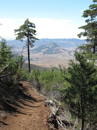
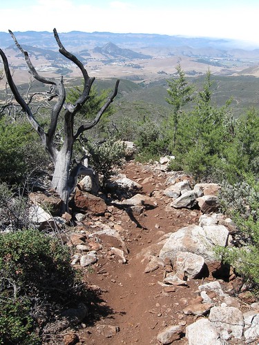
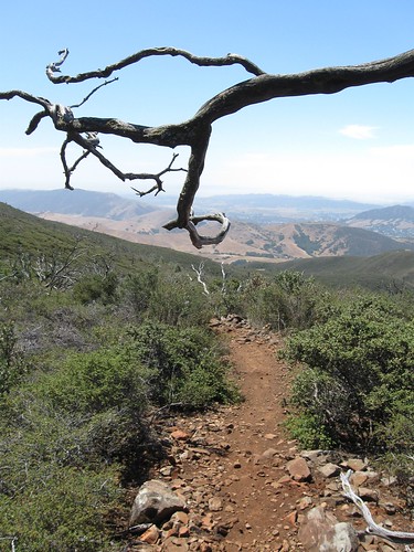
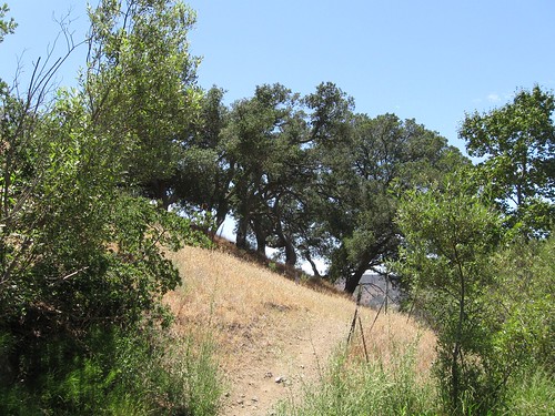
Once out of the oak forest and into the chapparal, the road stays close to the top of the steep ridge, revealing new prospects at every turn.
First was back down to the freeway going up Cuesta Grade.
clickpic for larger size
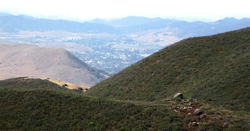
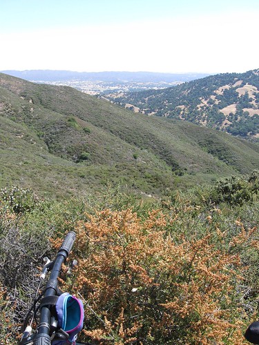
Toward the South, the fog crept in from the ocean and approached the city of San Luis Obispo.
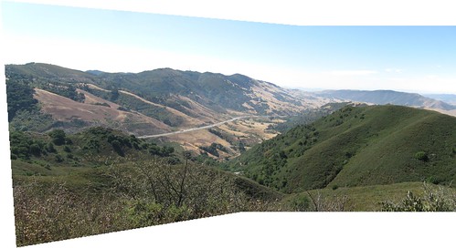
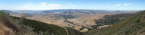
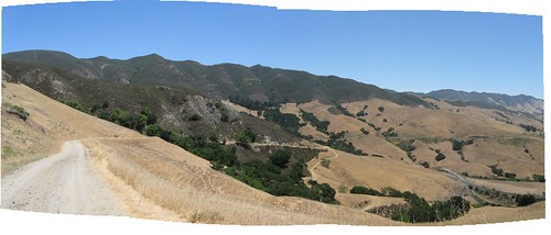
Around a turn, and spread below was a panorama of the Chorro Valley extending West to Morro Bay.
clickpic for larger size
To the North, I could see the Santa Margarita Ranch beyond the blooming chamise.
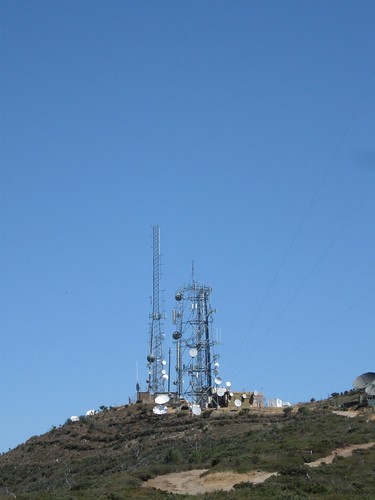
The TV tower complex, visible at a distance from our front deck in town, appeared like an outpost on Mars.
I remembered coming up here with Joe and Claire in his pickup truck shortly after he’d moved to Ketchum. We were able to see the snow-covered Sierras 200 miles across the Central Valley at that time, as did John Muir in 1900–but no more.
Hot and breathless after some steep uphills, I arrived at the Biological Reserve area where Jan and I had hiked before the 1994 Highway 41 fire transformed the whole landscape.
It was a California Native Plant Society outing led by Macolm McLoed through a forest of huge manzanita trees, their twisted muscular trunks covered with thin wine colored bark. Now all that’s left is their charred skeletons, still intact after fifteen years, along with the maturing chapparal, and the expanding grove of Sergeant Cypresses whose growth was stimulated by the fire.
Looking for the trailhead, I poked around the broken glass and other bits of trash left by people up here free to do their ugly thing out in the woods and found bike tracks leading to the start of an alluring single track that snaked through the dappled shadows.
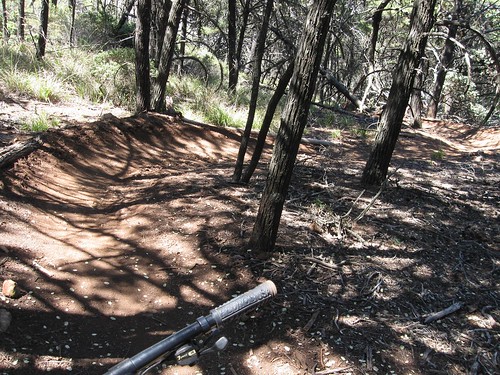
Nicely banked, smooth surfaced and switchbacking gently through forest cover and open views, I thought this was going to be the delightful descent described on the mountainbike trails website. I looked forward to exploring alternate routes and finding unknown tributaries to Chorro and Stenner Creek where I could stop to write in my journal and munch snacks.
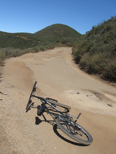
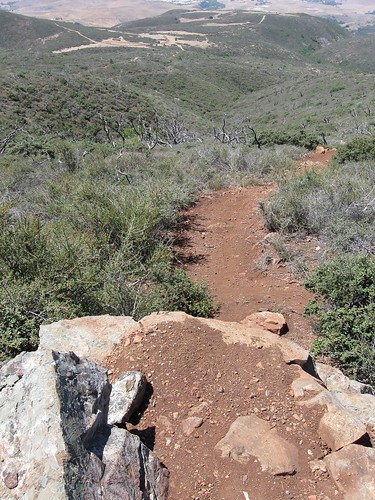
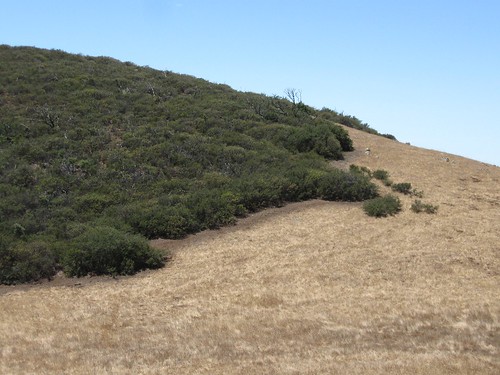
Within a couple of minutes the trail started getting rocky, forcing me to keep my back brake tight. Then the rocks got bigger and the trail steeper and I had to go so slow I couldn’t maintain balance to thread through the maze, or I had to squeeze the front brake also, making the back of the bike rear up and flip me forward like a bronco.
The burnt skeletons of the manzanitas overhanging the trail added a sinister frame to my struggles while the prospect of many miles of this kind of descent turned the excursion from an idyll to an ordeal.
clickpic for larger size
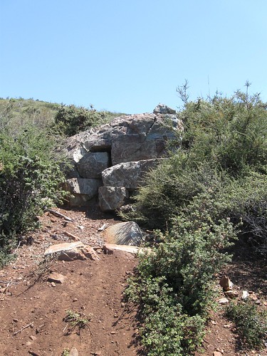
Who are the people that negotiate this kind of trail? I’d love to see some come by and show me their stuff, I thought, as I slid along on my feet next to the bike, gripping both brakes tight to keep it from tumbling down the hill on its own. At one point the trail led to a ten foot rock drop-off I had to carry the bike around. When he goes out with his friends, does Joe go off stuff like this? On a bike? On a motorcycle?
Around noon, I found a junction which I remembered the trail description mention as a place to turn left to keep on the single track. It turned uphill. To the right was a fire road heading down toward the Penitentiary and Camp San Luis, with one spur going back toward the railroad tracks and Stenner Canyon. I took it and was able to get back on the bike and bump my way along, climb over a couple of locked gates and head for the spur. I hiked up the hill and confirmed it would lead in the right direction and then returned to the bike to record the noonday zenith of heat and fatigue.
From there it was easy street to get the bike over the top and head down the road as it went from rock to grass, leveled out and meandered gracefully west and then east,
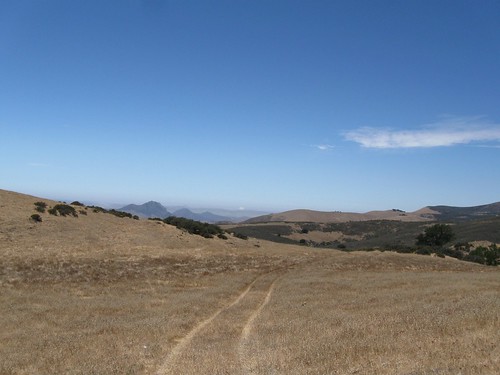
passing a beautifully defined ecotone between grassland and chapparal maintained by critters popping out from its cover to grab seeds and darting back in again to escape predators.
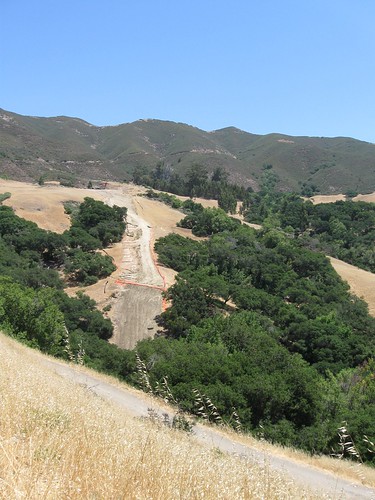
The double track ended in a recently graded gravel road used by the construction crews building the Nacimiento pipeline that will bring water to San Luis Obispo from a lake that almost disappears in drought years despite the fact that the city now has enough water to supply its own needs even in a drought. I coasted down, picking up speed, the long straightaways and gentle curves sliding by me to the crunchy sound of tires, the wind cooling my face, the view of Stenner and the ridgeline I’d climbed opening ahead.
clickpic for larger size
Rounding a turn to the north, above the main tributary of the Creek I saw a big gash in the oak forest outlined by orange construction site fencing. This was where the new pipline had just been buried, a scar 50 feet wide that wouldn’t heal, despite the phony mitigation of planting oak seedlings that would be eaten by deer and squirrels.
A familiar scene in a familiar place. The next tributary over, on the adjoining parcel of land owned by Cal Poly, the State Water Project put in a pipeline back in 1996 to provide for sprawl development in South County. I’d led a “Save the Oaks” campaign to keep them from cutting a 200 foot wide swath through the ancient oak groves that lined the banks, which included a high profile sit-in in front of a bulldozer. It succeed at reducing the swath to 20 feet wide by pressuring the Poly Administration to require that the state agencies tunnel through several knolls along the way instead of using their favored technique that’s since become known as Mountaintop removal.
I crossed the railroad tracks and homed in on that tributary to eat lunch by the creek I’d led many groups of people to see and from which Jan had taken vials of water to use for blessings to consecrate the spot.
I looked with affection at the grove specifically slated for destruction at the time, now still shading the trail.
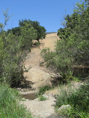
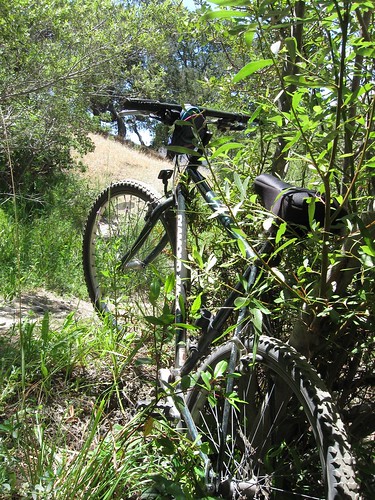
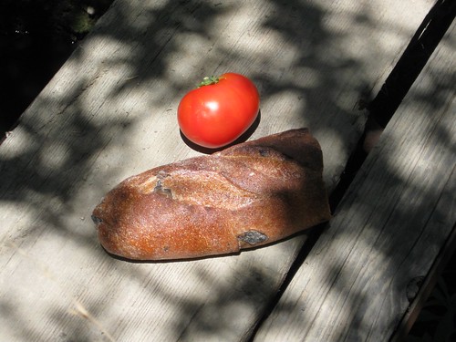
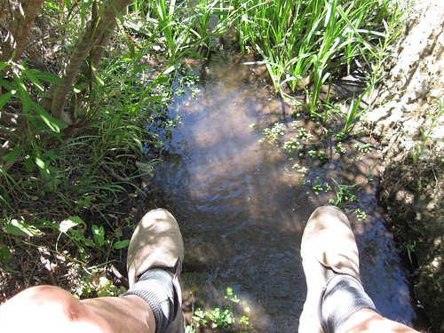
I parked my bike in the shade of willows, surrounded by lush verbena and monkeyflower and sat on the the one-plank bridge eating my bread and tomato, listening to the creek’s happy gurgle and watching the water striders dart after invisible bugs swept downstream by the current.
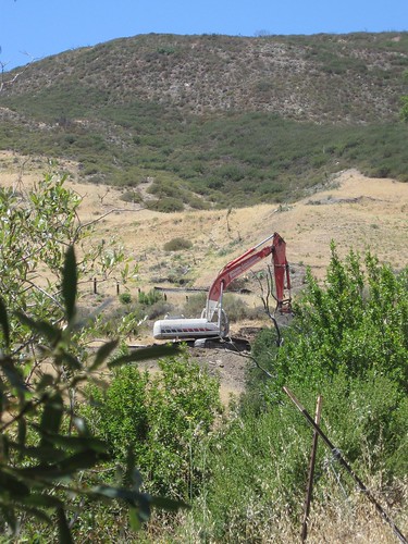
Suddenly a roar and a cloud of smoke erupted from above where I was sitting, just across the tributary. Then the great dragon of the excavator went back into action.
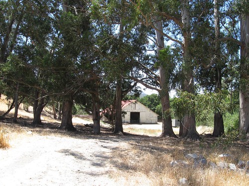
I finished the bread, got back onto the bike and dashed down the single track trail to the Serrano Ranch farmhouse and then home.