Backpacking in Grand Canyon (Day 2)
Next morning after early breakfast we drove into the National Park, passing elk wandering the roads. We left the car at the Backcountry Information Center where we had to wait over an hour to buy a map and receive advice to head down the Boucher Trail, which my earlier research alerted me was dangerously erroneous.

Then we took the red bus along the rim road to Hermit’s Rest, where I purchased a copy of John Wesley Powell’s The Exploration of the Colorado and its Canyons, and followed the Hermit Trail over the edge.


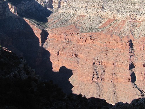
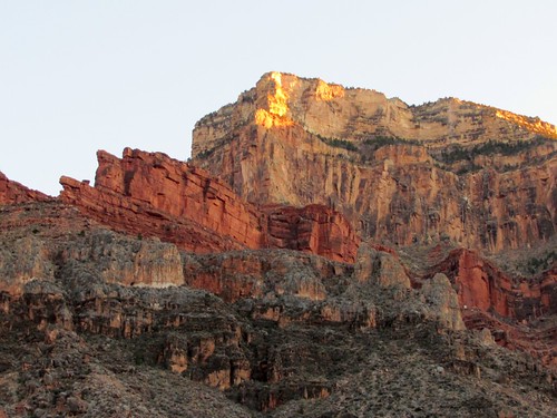
The hike was ecstatic at first, the canyon more Grand and awe inspiring than any landscape I’ve seen, including Yosemite and Zion: the light and colors of the rock more dramatic, the succession of views on the trail”ahead, behind, across, up, down”more varying, the eye continually arrested by unfamiliarity of shape, texture, and scale.


The trail was quite busy with hiker traffic in both directions. Three hours down we came across an attractive young woman sitting on a rock in the sunshine. She asked to see our permit and then stopped a large party passing by to see theirs. She told them they were too late to make it all the way to the site at the river where they were registered and signed a change order on the permit allowing them to stay at a closer one. Then she warned them not to make noise that could disturb others at the campsite. I told her that Steve was a half mile behind us carrying our permit and asked the penalty for camping somewhere without one. Two hundred eighty seven dollars she replied without smiling.
I was having extra fun playing with the new camera I had bought for the trip–a two hundred dollar 10x telephoto 10 megapixel hand-sized Canon, which replaced both the point-and-shoot I handed down to my grandson and the bigger but less powerful SLR I’d purchased just two years ago. At a turn in the trail that brought us for the first time within sight of the inner canyon, I wondered if a little blue dot in the middle of the view was some kind of gondola, and only after I took the picture could I recognize on the screen that it was actually the river.

After four hours of carrying my overloaded pack–from excess caution I’d brought along five liters of water in addition to the heavy food, tent and stove”on a trail that got steadily steeper, more fractured and more littered with stones, the fun ended. The splendor of scenery, the invigoration of exercise, the stimulation of good company gave way to pain, fatigue and anxiety. I ached in the shoulders from the pack straps, in the upper arms from bearing weight with the trekking poles, in the knuckles from gripping them, in the spine from the packs’ rubbing, in the stomach and side and thigh and calf muscles from tensing against the weight, in the hip and knee and ankle and big toe joints from internal friction at every step, in the thickened toenails crushed by my boots, and in the ears jarred by the clank of poles against rocks.
This was predicted by the well-written Park Service Bulletin about the trail:
The Hermit Trail is unmaintained, the ruins of a pathway that hasnt seen a trail crew in 80 years….The trail runs across an angle of repose slope, crossing high gradient drainages at roughly perpendicular intersections. ¦the trail has been badly damaged by the same erosional forces that shaped the larger canyon. Hikers must scramble across chaotic jumbles of rocks washed down or fallen from above every time the trail crosses a gully. It is possible to lose the trail entirely where breakdown has covered the original route¦The uncertain footing as well as the impression of exposure presented here has caused inexperienced canyon walkers to conclude that they are engaged in a truly hazardous enterprise.
The descent becomes unrelenting at Cathedral Stairs. An endless series of rocky switchbacks eventually leads hikers through the Redwall cliff and down the talus below Cope Butte….
As we made our way down that cirque of Cope Butte toward the more level Tonto Platform, I resorted to the emergency tactic I’d used while hiking with grandkids and Jan: talk distraction.

I asked Steve his worst hiking experience and he told me of the forty mile walk he took from Gold River to Tahsis and of his hair-raising climb up Bear Tooth, and I told him of my 1962 hike up the mountain in Yellowstone to the fire lookout I was stranded in for three days out of exhaustion.
After a rest stop at the trail junction, some gorp and two more Aleves, I got a second wind, and could again enjoy the sunset light on the buttes across the river. Miraculously, Steve’s wounded knee, a concern for all of us, showed no signs of further injury.

We ambled on to a solid rock campsite several miles short of the one where we were permitted to stay, but safe from the citation-dispensing rangers at this time of night.

We prepared an easy Thanksgiving meal”two cups of boiling water poured into envelops of dehydrated Turkey Tetrazzini–more than good enough to merit gratitude. As the sun set, I blew up my Thermarest, crawled into the sleeping bag, rested my head on the unpitched tent and reveled in the sensation of relaxing muscles.

The stars were clear and the air mild”twenty degrees above the chilly rim four thousand feet overhead. I woke up several times without having to get out of the sleeping bag, following Steve’s suggestion to pee in a water bottle which remained comfortably warm beside me. The waxing moon flooded the cliffs with light and then disappeared behind them. Three shooting stars flared.
