The Zunoquad

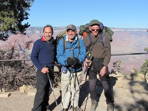
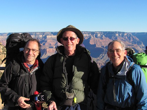
Backpacking in Grand Canyon (Day 2)

Wednesday, December 9th, 2009

full photoset and slideshow

Next morning after early breakfast we drove into the National Park, passing elk wandering the roads. We left the car at the Backcountry Information Center where we had to wait over an hour to buy a map and receive advice to head down the Boucher Trail, which my earlier research alerted me was dangerously erroneous.

map.jpg

fullsize map and itinerary

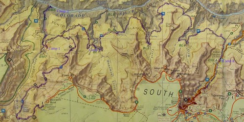
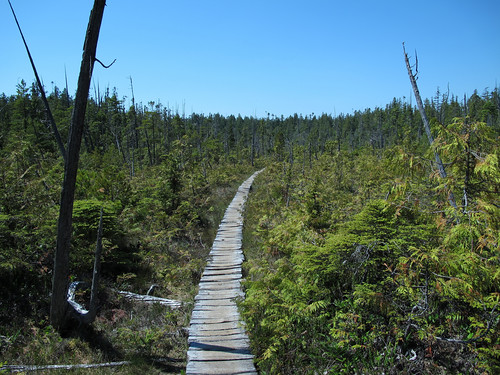
Then we took the red bus along the rim road to Hermit’s Rest, where I purchased a copy of John Wesley Powell’s The Exploration of the Colorado and its Canyons,  and followed the Hermit Trail over the edge.

IMG_0200.JPG

IMG_0203.JPG

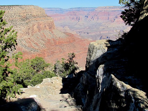
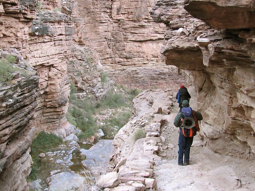
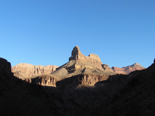
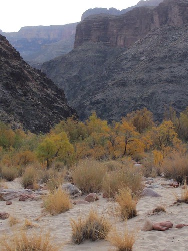
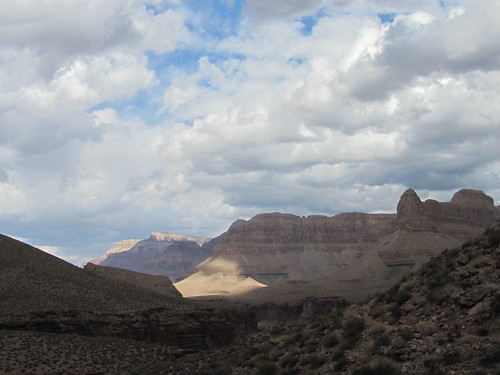
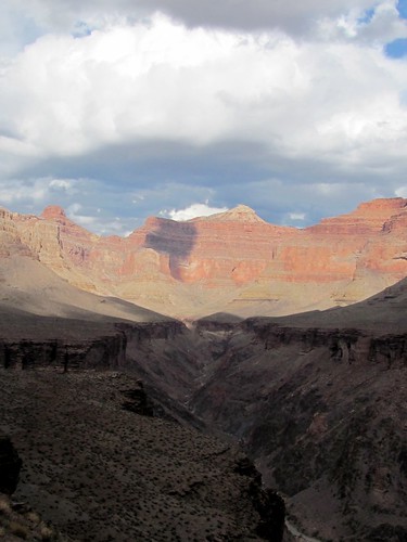
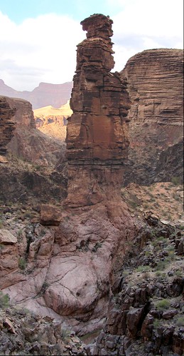
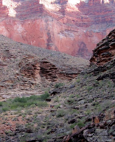
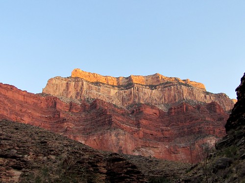
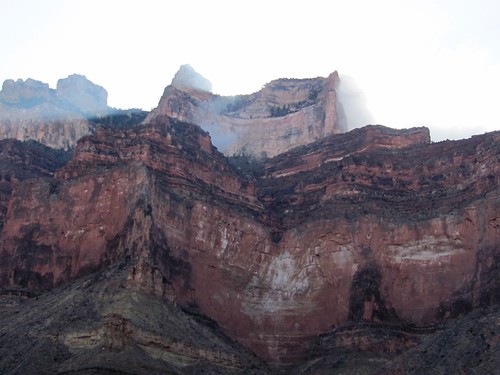
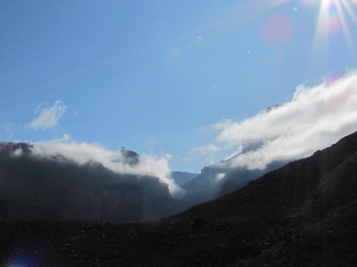
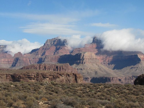
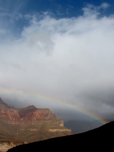
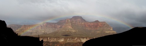
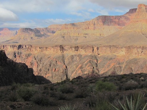
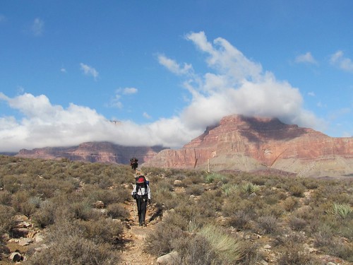
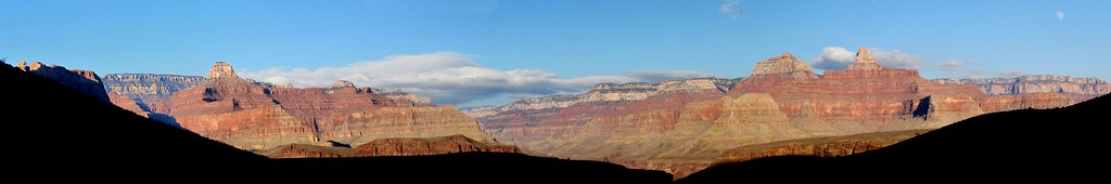
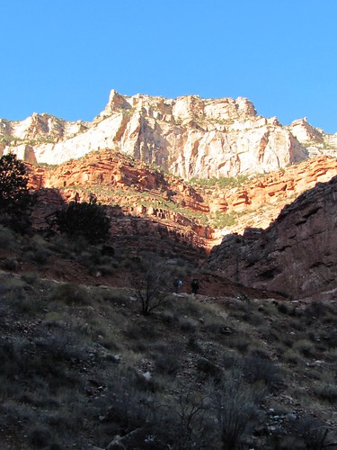
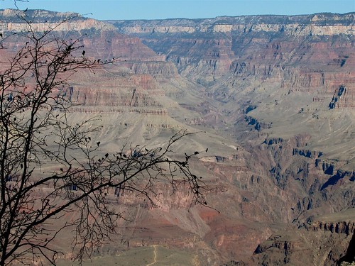
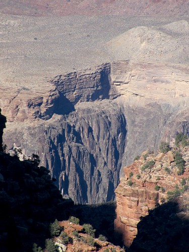
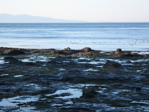
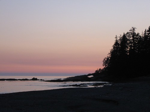
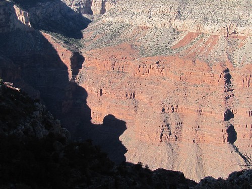
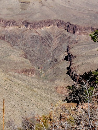
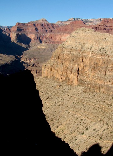
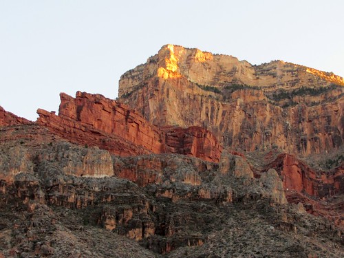
The hike was ecstatic at first, the canyon more Grand and awe inspiring than any landscape I’ve seen, including Yosemite and Zion: the light and colors of the rock more dramatic, the succession of views on the trail”ahead, behind, across, up, down”more varying, the eye continually arrested by unfamiliarity of shape, texture, and scale.

IMG_0204.JPG

IMG_0214.JPG

IMG_0217.JPG

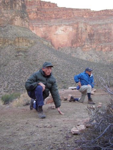
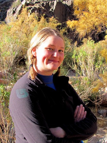
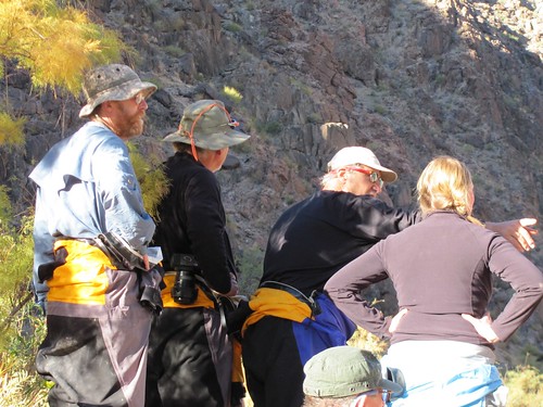
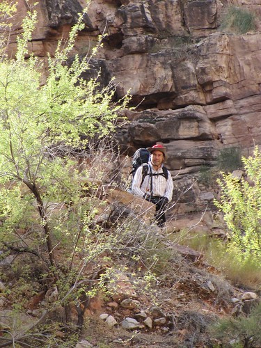
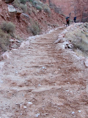
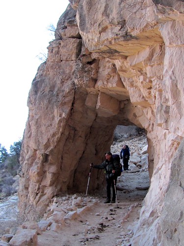
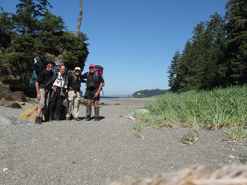
The trail was quite busy with hiker traffic in both directions.  Three hours down we came across an attractive young woman sitting on a rock in the sunshine.  She asked to see our permit and then stopped a large party passing by to see theirs.  She told them they were too late to make it all the way to the site at the river where they were registered and signed a change order on the permit allowing them to stay at a closer one.  Then she warned them not to make noise that could disturb others at the campsite.  I told her that Steve was a half mile behind us carrying our permit and asked the penalty for camping somewhere without one.  Two hundred eighty seven dollars she replied without smiling.

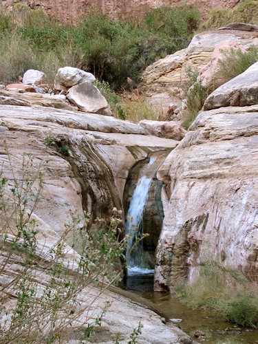
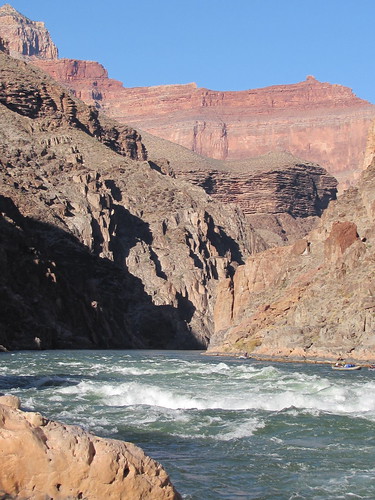
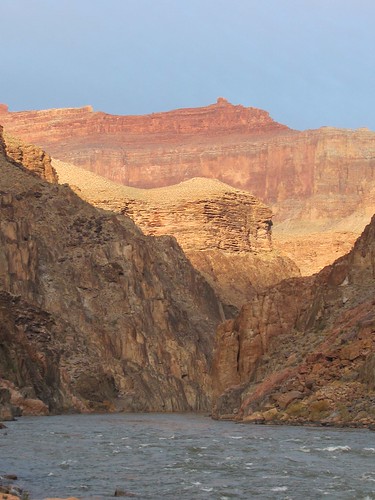
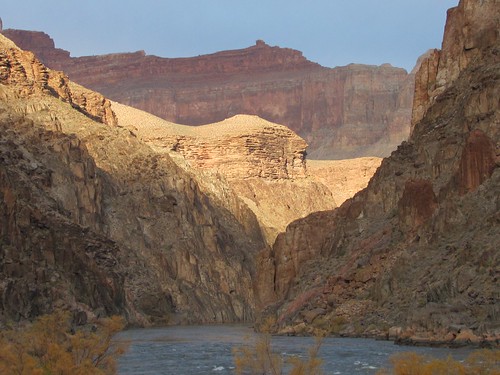
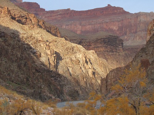
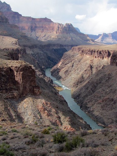
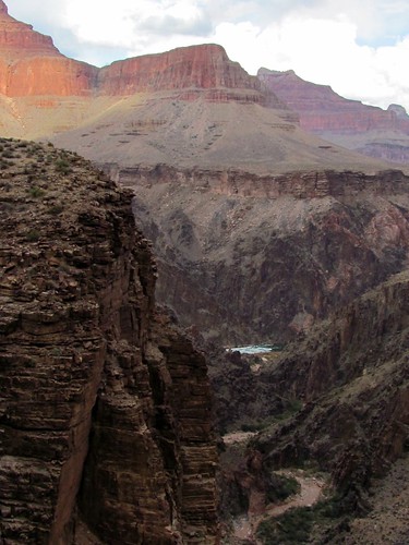
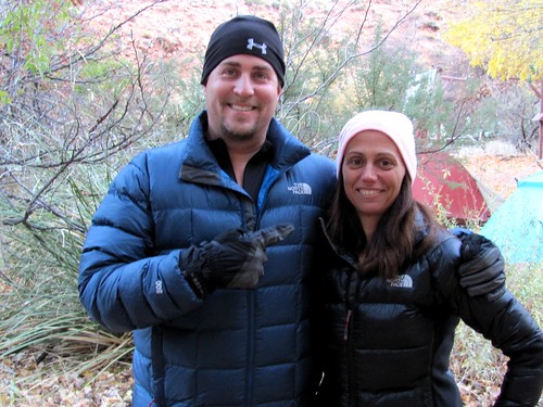
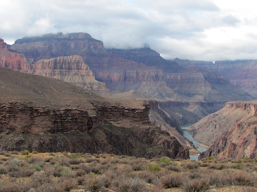
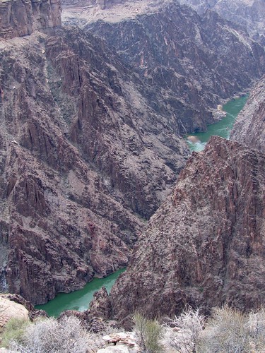
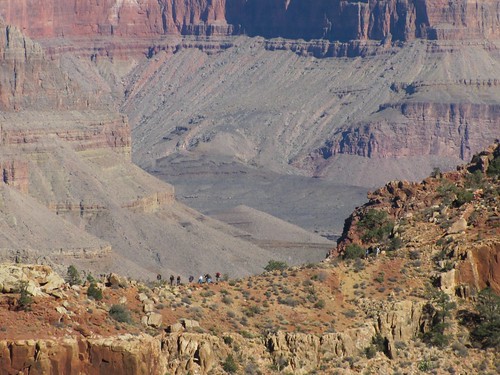
I was having extra fun playing with the new camera I had bought for the trip–a two hundred dollar 10x telephoto 10 megapixel hand-sized Canon, which replaced both the point-and-shoot I handed down to my grandson and the bigger but less powerful SLR I’d purchased just two years ago.  At a turn in the trail that brought us for the first time within sight of the inner canyon, I wondered if a little blue dot in the middle of the view was some kind of gondola, and only after I took the picture could I recognize on the screen that it was actually the river.

IMG_0216.JPG

fullsize picture

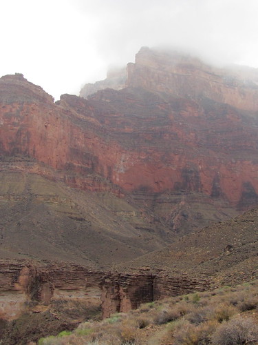
After four hours of carrying my overloaded pack–from excess caution I’d brought along five liters of water in addition to the heavy food, tent and stove”on a trail that got steadily steeper, more fractured and more littered with stones, the fun ended. The splendor of scenery, the invigoration of exercise, the stimulation of good company gave way to pain, fatigue and anxiety.  I ached in the shoulders from the pack straps, in the upper arms from bearing weight with the trekking poles, in the knuckles from gripping them, in the spine from the packs’ rubbing, in the stomach and side and thigh and calf muscles from tensing against the weight, in the hip and knee and ankle and big toe joints from internal friction at every step, in the thickened toenails crushed by my boots, and in the ears jarred by the clank  of poles against rocks.

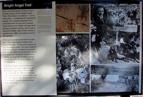
This was predicted by the well-written Park Service Bulletin about the trail:

The Hermit Trail is unmaintained, the ruins of a pathway that hasnt seen a trail crew in 80 years….The trail runs across an angle of repose slope, crossing high gradient drainages at roughly perpendicular intersections.  ¦the trail has been badly damaged by the same erosional forces that shaped the larger canyon. Hikers must scramble across chaotic jumbles of rocks washed down or fallen from above every time the trail crosses a gully.  It is possible to lose the trail entirely where breakdown has covered the original route¦The uncertain footing as well as the impression of exposure presented here has caused inexperienced canyon walkers to conclude that they are engaged in a truly hazardous enterprise.

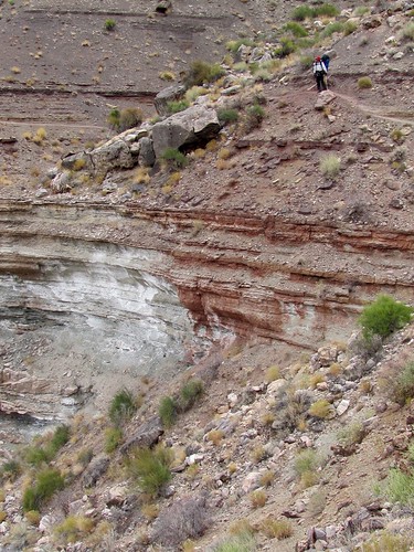
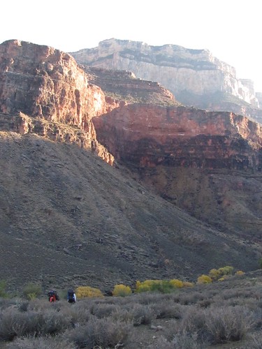
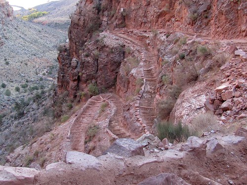
The descent becomes unrelenting at Cathedral Stairs.  An endless series of rocky switchbacks eventually leads hikers through the Redwall cliff and down the talus below Cope Butte….

As we made our way down that cirque of Cope Butte toward the more level Tonto Platform, I resorted to the emergency tactic I’d used while hiking with grandkids and Jan: talk distraction.

IMG_0245.JPG

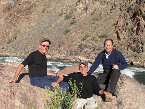
I asked Steve his worst hiking experience and he told me of the forty mile walk he took from Gold River to Tahsis and of his hair-raising climb up Bear Tooth, and I told him of my 1962 hike up the mountain in Yellowstone to the fire lookout I was stranded in for three days out of exhaustion.

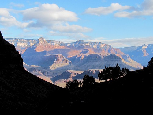
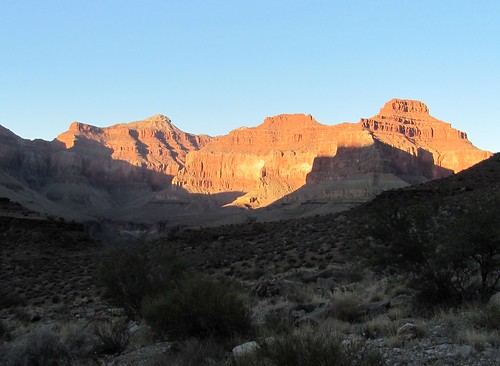
After a rest stop at the trail junction, some gorp and two more Aleves, I got a second wind, and could again enjoy the sunset light on the buttes across the river. Miraculously, Steve’s wounded knee, a concern for all of us, showed no signs of further injury.

IMG_0254.JPG

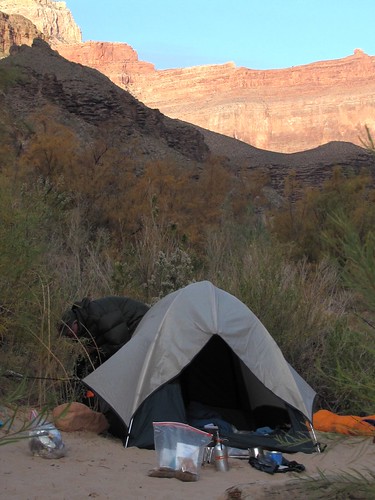
We ambled on to a solid rock campsite several miles short of the one where we were permitted to stay, but safe from the citation-dispensing rangers at this time of night.

IMG_0269.JPG

We prepared an easy Thanksgiving meal”two cups of boiling water poured into envelops of dehydrated Turkey Tetrazzini–more than good enough to merit gratitude.  As the sun set, I blew up my Thermarest, crawled into the sleeping bag, rested my head on the unpitched tent and reveled in the sensation of relaxing muscles.

IMG_0257.JPG

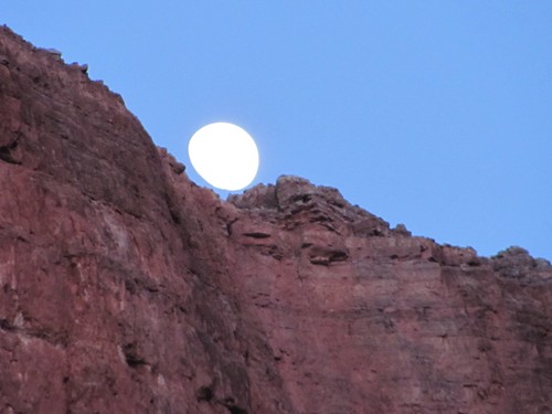
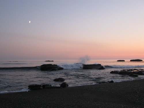
The stars were clear and the air mild”twenty degrees above the chilly rim four thousand feet overhead. I woke up several times without having to get out of the sleeping bag, following Steve’s suggestion to pee in a water bottle which remained comfortably warm beside me.  The waxing moon flooded the cliffs with light and then disappeared behind them. Three shooting stars flared.

Backpacking in Grand Canyon (Day 3)

Wednesday, December 9th, 2009

full photoset and slideshow

After 12 hours of rest, we awakened in the predawn and packed up quickly to vacate the unauthorized spot.  I wished we’d had coffee.  Before starting out we dutifully stretched,

GC 055.JPG

and as the light came up we descended into a tight curvy canyon gouged out of the shale strata of the Platform that reminded me of the hike through Zion canyon I’d taken with Joe and Amy in 1995, during which he went off into a side canyon with her and proposed.

IMG_0275.JPG

The sound of flowing water echoed as we approached Hermit Creek graced with little cascades and rich vegetation.

IMG_0288.JPG

The old trail, originally constructed by the Santa Fe Railroad as part of a luxury resort serviced by a cable tramway from the rim, wound under rock overhangs down to a place where the neat horizontal layers through which we’d descended since yesterday were replaced by swirling shapes of hardened basalt laced with multicolored and multitextured stone.  We were entering the “basement” of the canyon, the deepest portion carved by the river and its tributaries that exposed rocks estimated as two billion years old.  The shale layers directly above them were supposed to be 500 million years younger, making for the “Great Unconformity,” in which the geological record had disappeared.  To mark the change, large clumps of overlying strata had fallen into the canyon on the opposite side of the creek. On the trail side we stopped to marvel at granite embedded with huge flakes of mica interspersed with quartz in bright shades of red, white and black.

IMG_0297.JPG

IMG_0298.JPG

As the canyon straightened near the bottom, we suddenly saw the pillar of Ra flaming above us and heard the roar of the river ahead.

IMG_0304.JPG

Then the walls on our side opened to reveal sky and brilliantly colored cliffs upstream and down.  We were at the Hermit Rapids and didn’t have to leave until the following morning!

IMG_0305.JPG

We had a choice of empty campsites and picked one in soft, warm sand right on the riverbank surrounded by tamarisks and willows .

Before unpacking and lighting the stove for coffee, we clambered over some large rocks for a look at the rapids themselves and  were joined by a young woman, Ingrid, one of a group of kayakers and rafters on a 27 day journey on the river.

IMG_0309.JPG

She was soon surrounded by a crowd of men young and old who charted a course through the fast flowing turbulence.

IMG_0316.JPG

They had camped here last night after swamping in Granite Rapids upstream and were just ready to take off.  Regretting the delayed coffee but excited to watch and take pictures of their daredevilry,  we waited beside the clean, green racing river that had carved the masterpiece engulfing us.

IMG_0320

The spectacle was worth the delay.  First came Ingrid and another kayaker in their tiny solo boats.

IMG_0337

Then the rafters, some in twos, some by themselves.

IMG_0334

This was no guided tour; they were all highly experienced River Rats who owned their equipment and lived for the sport, according to Mike P., the grizzled rower who left his email address. Once they had all run the rapids, they assembled in the eddy below and then disappeared around the blind curve ahead.

IMG_0331

We set up our gear, boiled water for coffee and oatmeal, and luxuriated in the prospect of a day of rest and relaxation.  Despite the long sleep the night before and the stimulant, we all napped for a couple of hours, Peter after taking a dip in the icy water that flowed from the bottom of the dam upstream at Glen Canyon.

IMG_0394.JPG

In the afternoon we went exploring the creek and beaches and rock formations of this wondrous oasis in the midst of vertical walls that otherwise made the river unapproachable from land.

IMG_0412.JPG

IMG_0416.JPG

I started reading Powell’s enthralling account of his 1869 trip down the river.  He was the one-armed leader of a small expedition of wooden boats, which by the time they had reached here had lost most of their tools and provisions and still had they knew not how far to go and what awaited them ahead.

As I stood munching our lunch of salami and cheese, I looked up at the cliff behind the campsite and saw moving shapes.  Two of the canyon’s legendary mountain sheep were browsing on the low ridge line no more than 200 feet away.  “Get your cameras,” I whispered, pulling mine from its holster.  Eager as any hunter to shoot, we captured the quarry.

IMG_0390.JPG

IMG_0391.JPG

Click last two images for full-size versions

Backpacking in the Grand Canyon (Day 4)

Sunday, December 13th, 2009

full photoset and slideshow

The preceding night’s long sleep, the day’s light exertion and even the nap didn’t prevent us from hitting the sack soon after early nightfall.  Not only did  our creaky bodies crave extra rest since the big descent, living outdoors increased synchronization between the anatomical clock and the seasonal one.  Drifting off to sleep felt like hibernating–to conserve and store energy, and also to continue a winter journey into the underworld.

Two days earlier the permit-checking ranger had said that we’d be in for a change in the weather Saturday, and the morning sky seemed to confirm her warning.  Our itinerary called only for a five mile hike today, mostly on a good trail, with no great altitude changes, so we dallied at the river, adding stewed dried fruit to our outmeal, brewing an extra pot of coffee, further exploring the little oasis and gawking at dancing patterns of light and shadow projected on the canyon’s  walls  by thick fast moving clouds.

IMG_0403.JPG

IMG_0411.JPG

IMG_0414.JPG

Relieved of unnecessary weight and the straps better adjusted, on the way  up through Hermit Canyon the pack felt more like a strong hug than a troublesome burden, and the effort to escape gravity while ascending was easier on the joints than resisting it on the way down.

IMG_0425.JPG

Once back on the Tonto trail heading eastward on the Platform, it was possible for the first time to enter the springy rhythm of forward motion propelled by the momentum of extra weight that for me makes hiking a real sport.  Cruising this wide plateau–continuous across both banks of the inner canyon, which usually hides, but then suddenly gapes at one’s feet with a fifteen hundred foot drop either to the flowing Colorado or the tributary gullies the trail must circumvent by leading back to the base of walls and buttresses and towers that stretch higher overhead with every step–under a sky that transforms momentarily from a limitless expanse of light to a dampening ceiling of fog made walking feel like flight.

IMG_0431.JPG

IMG_0439.JPG

IMG_0434.JPG

IMG_0520.JPG

Like the canyon itself the trail’s track through space performed tricks with time.  It led a leisurely traverse around the base of Cope Butte, the harshest section of the descent two days ago,  and above the river it provided a retrospect of yesterday’s idyll at Hermit Rapids.

IMG_0443.JPG

IMG_0446.JPG

As the afternoon shadows deepened we passed along the edge of Monument Creek’s side canyon eager to find the campsite at its head before dark.  The trail twisted off the Platform down into a tight gully through which we could hear water flowing toward the river.

IMG_0452.JPG

After debating which of the many surrounding formations above us could be the named Monument, the answer was suddenly obvious looming from below. The top two thirds of the column consisted of brownish fractured sandstone layers, the bottom third of rounded pink lobes.

monument.jpg

As the trail dropped into the basement level of rock formation, the colors on the wall beside it became even more unearthly than those in Hermit Canyon.

IMG_0457.JPG

IMG_0459.JPG

This campsite offered the succor of perennial creek water that could be purified and harvested to fill our drinking bladders, coffeepot and dehydrated dinner envelops. In addition it provided a toilet conspicuously absent from last night’s where we had to search fruitlessly for a satisfactory place among the rocks for our leavings and make unpleasant acquaintance with the deposits of others.  Like in many other recreational wilderness situations, this is more of a problem than might be expected, and we felt grateful for the stinky and prominent facility here provided.

IMG_0466.JPG

A large party of backpackers had occupied the marked campsites and so tight was the gully that the sound of their amiable voices boomed around us, so we relocated to a more solitary spot, again unauthorized but well used, to pitch the tent and cook supper in the light of a brilliant sunset and haunting moonrise.

IMG_0483.JPG

IMG_0493.JPG

The pole stretching the fly on my two-person tent had become deeply bowed over years of use, and Steve exerted his design skills to straighten it, to great advantage, since in the middle of the night the wind blew and the rain pelted down but inside we stayed cozy and dry.

IMG_0479.JPG

Backpacking in the Grand Canyon (Day 5)

Monday, December 14th, 2009

full photoset and slideshow

Come rain or  shine this day’s destination was eleven miles along the Tonto trail, so we broke camp early and dressed for rough weather, leaving behind a woman in the large group of hikers whom Steve had provided with  prescription painkillers he had brought just in case.  The night before she was in severe distress because of an injury to her knee, and we expected that she’d either have to be carried the distance by her friends or helicoptered out.  An hour down the  trail, carrying a full pack, Diana passed us with a smile that was still on her face when we met again at the end of our full day’s trek.

IMG_0577.JPG

The  skies this morning were moody and unstable, reminding me of Powell’s admirable description:

Clouds are playing in the canyon today.  Sometimes they roll in great masses, filling the gorge with gloom; sometimes they hang aloft from wall to wall and cover the canyon with a roof of impending storm, and we can peer long distances up and down this canyon corridor, with its cloud-roof overhead, its walls of black granite, and its river bright with the sheen of broken waters.  Then a gust of wind sweeps down a side gulch and, making a rift in the clouds, reveals the blue heavens, and a stream of sunlight pours in.  Then the clouds drift away into the distance, and hang around the crags and peaks and pinnacles and towers and walls, and cover them with a mantle that lifts from time to time and sets them all into sharp relief.  Then baby clouds creep out of side canyons, glide around points, and creep back again into more distant gorges.  Then clouds arrange in strata across the canyon with intervening vista views to cliffs and rocks beyond.  The clouds are children of the heavens, and when they play among the rocks they lift them to the region above. (p. 256)

Rather than just depicting the landscape, his description recreates it for me. So do the photos  I snapped and later processed, which I see now complemented and enhanced by Powell’s account:

IMG_0558.JPG

IMG_0540.JPG

IMG_0552.JPG

IMG_0556.JPG

Sitting at my computer two weeks after the trip, reviewing his words to stimulate my own, I feel connected with that heroic voyager in 1870 transcribing and embellishing his watersoaked journal to prepare it for publication.

In the late morning as the trail skirted the inner canyon and rounded a turn into the drainage of Salt Creek the sky went threateningly dark. I understood why this section was named on the map as “The Inferno.”  The assemblage of fractured, knife-sharp points and ridges lining the great gash in the earth seemed to drink up light like a black hole, recalling Milton’s description of hell as “darkness visible” or Dante’s prospect of the lowest section of the underworld: “We came to the edge of an enormous sink/Rimmed by a circle of great broken boulders” (Canto XI)

IMG_0516.JPG

It started to rain hard, but just as I unpacked my waterproof pants, to the south the clouds parted  to produce another metaphysical sign.  It emerged from the depths of the abyss below

IMG_0546.JPG

and arched from one bank to another of  the side canyon

IMG_0529.JPG

IMG_0531.JPG

perfectly framing the Isis Temple on the north side of the river.

rainbowpan.jpg

larger size image

As the sun achieved dominance and its rays illuminated the inner walls, their colorless obscurity took on a rosy-veined glow.

IMG_0538.JPG

mirroring the pink spines clustered at the center of a barrel cactus.

IMG_0554.JPG

In the clear afternoon, it felt like The Great Outdoors was beaming on us as we sauntered along, brimming with joy and awe.

IMG_0555.JPG

But the blessing was also human: my old Lund companions who got these excursions going, and the gear I wore and carried, which allowed me to range comfortably and safe:

  • my Dana Designs packsack that Joe had picked out for me in Moab fourteen years ago
  • my Danner boots from Takkens that I’d just had resoled
  • my Leki trekking poles that saved my knees on the way down and now, as my wrists swiveled in the straps, advanced me from  a two to a four legged creature
  • my pretty REI tent that took five minutes to pitch and had kept the wind and rain out last night
  • my Camelback bladder that taught me the  difference between drinking and hydrating
  • my ancient REI down sleeping bag, now patched with duct tape
  • my Thermarest mattress, easily patched after having been penetrated by a sharp stick while serving as a river raft for grandsons
  • my new Brunton stove, weighing no more than a pound and able to boil a litre and a half of water in three minutes
  • my tiny headlamp that never wore out its cheap batteries but provided enough light to work and read in the dark
  • my Sierra Designs rainshell bought in Powell river in August which had already protected me in four storms
  • my two layers of well used First Lite merino wool underwear that Kenton had sent  last summer
  • my weightless cashmere scarf that Amy made me for Christmas, soft as her voice, warm as her smile

The Platform flattened and widened as we passed the last four-thousand foot buttress between us and our destination of Indian Gardens.  The panorama unfolded: a long reach of the river lined with dozens of brilliantly colored monuments intersected by Bright Angel Canyon, a fifteen-mile perpendicular corridor leading back to the snow-bedecked north rim.

larger size image

It was a moment I didn’t want to let pass.  I walked off the trail and sat in the newly washed desert gravel, stared, meditated and played my recorder.

GC 186.JPG

Then it felt time to go on.  A grove of golden cottonwood trees, incongruous but inviting, beckoned from the creek bed ahead.  The poles of an old telephone line appeared at intervals at the cliff base.  The trail broadened and showed signs of heavy travel and regular maintenance.

IMG_0563.JPG

We trudged into Indian Gardens campground, admired the stonework of old buildings and walls and the varied assortment of large trees planted a hundred years ago by early tourism developers. We chatted with the voluble ranger who lived here in a house with TV and  power, filled our pots with potable water directly from the tap and ate dinner at a picnic table under a steel-roofed shelter.  Even though on a gentle grade and a good trail, ten hours of hiking left us ready for our sleeping bags before nine p.m.

Backpacking in the Grand Canyon (Day 6)

Tuesday, December 15th, 2009

full photoset and slideshow

Awakening and packing on the last day of the hike was accompanied by familiar bittersweet emotions.  The amazing winter light painted a picture to remember of the fantasy world we were leaving, framed by the side canyon’s shadows, and it ignited the sparkling white limestone near the South Rim where we were headed.

IMG_0583.JPG

IMG_0582.JPG

On a sign detailing the history of property disputes over control of the trail leading down was taped a notice that it would be closed for some time this morning to facilitate a helicopter salvage operation.

IMG_0623.JPG

The trail itself was wide enough to accommodate hikers side by side with the pack trains led by central-casting  mule-skinners.

IMG_0584.JPG

Surfaced with pulverized sandstone that was soft and springy to the feet and decoratively bordered with stable boulders, it snaked at a gentle grade along ledges carved in the pink sandstone.

IMG_0596.JPG

Travel along it was once again vertical rather than horizontal–the same stretch of canyon above and below dramatically altering as the changing angle of view hid and revealed features.

IMG_0603.JPG

IMG_0615.JPG

An hour or so into the ascent, we heard the thumping of a large helicopter, which appeared in the sunlight above the rim, disappeared behind a buttress and soon reappeared dangling a miniscule-looking car from a long cable.

IMG_0587.JPG

This, the ranger had informed us, was the remains of a vehicle deliberately driven over the edge by a suicide some months earlier. 

As we ascended toward the 7000 foot elevation of the rim, the temperature dropped and the air thinned, requiring regular short pauses for breath.  Nevertheless, greeting the steady flow of daytrippers from above swelled our pride in being grubby veteran adventurers. 

A tunnel bored through the rock just below the edge marked the trail’s end.

IMG_0608.JPG

While we stood for our portrait to be taken by some polyester-garbed fellow-retirees in the parking lot, Steve chatted with them about the football team fortunes of their shared alma-mater in Cincinnati, Ohio.

IMG_0622.JPG

Hiking the West Coast Trail (1)

Saturday, August 28th, 2010

This trip was tentatively planned during our hike of the Nootka Trail last summer. Peter had done it 27 years ago with his ten year old son and it retains the reputation of being one of the world’s best hiking trails. Paul did the prep work of determining the best time for tides and weather and being  first in the lineup for reservations, which came to close to $200 per person. Access is tightly controlled by Parks Canada which allows about 6000 people a year to make the trip.

The trip concluded a long summer holiday which involved Jan and my driving from San Luis Obispo to Knoll House in Lund B.C., spending ten days there with children and grandchildren, driving to Eastern Oregon for the wedding of a relative, driving to Portland, from where Jan and the dog flew back to San Luis in time for her City Council meeting, and my driving from Portland to Port Angeles, where I left the car and ferried to Victoria to meet Peter on the way to the trailhead.

August 9 Heart of the Hills Campground, Olympic National Park WA

Inside a cloud, dark and grey under the old-growth spruces and cedars. The campground quiet and underpopulated.

A family pulls up to the neighboring campsite: 2 parents, black and white, and their five-year old boy.  His high, loud voice echoes in the forest stillness.  His parents are patient, loving, full of instruction and rule.

I used my senior passport to get in free and pay only 6$ to camp. Sinus pressure and cough just returned. Will I need more antibiotics before the hike?

I repack my backpack for the third time on the picnic table, always subtracting. I’m worried about the weight.

August 10

Awake at 6 AM, no sign of illness. But the threat remains, increasing desire to keep trying limits while I can.  I’ll see what the weight is like on a trail this morning.

Two and a half hours later I return, glad to set the pack down, but not exhausted or in pain.  No Aleve needed now for the knees. The trekking poles work wonderfully”absorbing shock and adding forward momentum, allowing  me to walk like a quadruped.

More sorting and packing: what goes in the hike pack, what in the Victoria pack, what stays in the car. In my journalette, I map what’s where in the pack. I’ll look up those locations instead of searching for things.  Mindfulness.  I’m reading “Buddha’s Brain.”  I practise on the trail: attention to breathing, movement of feet, the quiet.

Why do this? Expend the time and money, take on the preparation, discomfort, and risks?  To encounter simple necessity, to escape family and state, to find friendship and solitude, to return with pictures and words.  For adventure, a venture, face the unknown, experience engagement, not detachment.  Jan prefers different ventures: running for mayor, facing opponents, managing organizations.

August 11

Peter picks me up at 6:00 A.M. in front of Ann’s house, where I crashed after ferrying by foot from Port Angeles.  I feel royally accommodated. At Port Renfrew we eat a big breakfast at fisherman’s restaurant and drive to the trail information center located on an Indian Reserve strewn with garbage and half-wrecked houses. The mandatory orientation lecture a fast paced forty minute Powerpoint detailing dangers and challenges to a room full of people who’ve succeeded in getting one of a limited number of reservations, eager to get going.

A tiny ferry ride, then five and a half hours walk through dappled first-growth forest, steep verticals, the rough trail made somewhat easier by long ladders leading into and out of deep gullies gouging impassable headlands.

IMG_0928.JPG

4914991376_d15011105d_b.jpg

It’s the shakedown experience alternating between challenge and ordeal. I’m bathed in sweat and drink 3 litres of water.

4914989276_784c2cc6f2_o.jpg

The last section descends 200 rungs to the beach at Thrasher Cove, where we share the campsite with about 30 others.  I cook quinoa and lentil curry and chocolate pudding from Trader Joes for appreciative mouths, lightening my pack 4 lbs.

IMG_0556.JPG

[Full set of 196 pictures, slideshow and all sizes]

Hiking the West Coast Trail (2)

Saturday, August 28th, 2010

August 12

First two hours this morning were brutal.  Climbing over house-sized, sharp, slippery boulders and huge piles of logs with heavy packs.

IMG_0563.JPG

Steve fell twice.  I watched him go down and get back up.  Each could have been the end of his trip, adding to this summer’s 62 evacuations.

4914997334_a78d2b4803_b.jpg

Paul, eager and strong, always in the lead.

IMG_0567.JPG

I enjoy approaching my limit.  Pain, sweat, fatigue, and breathing hard focus the mind on here and now.

Scenery gains beauty as we approach sea stacks on the point.  Once around it, the beach flattens, the broken granite and basalt now blanketed with a wide sandstone shelf. We enter a dark network of softly sculptured channels that reflect rainbow-colored bands of algae growing on walls supporting the ancient forest above.  Views are framed by sculpted arches and windows opening inward on a labyrinth of caves and outward on offshore islands covered with the rounded bodies of basking sea lions.

IMG_0581.JPG

IMG_0585.JPG

IMG_0597.JPG

IMG_0604.JPG

IMG_0605.JPG

We put down packs and wander through this wonderland, then sit and munch crackers and salami.  Two young women I’d greeted at Thrasher Cover come round the point carrying packs larger than ours. We share relief at the change in topography and excitement at the splendor of the caves. They set down packs and the blond removes her sweater revealing a nicely rounded belly.

A walk on the flat beach, skirting the surge channels impassable at any but low tides and then back up to the bush trail with more steepness, ladders, wooden walkways.

IMG_0606.JPG

IMG_0608.JPG

The history of the trail as a rescue route for shipwrecked mariners is evidenced in telegraph wire insulators embedded in tree bark.

IMG_0739.JPG

A few old logging sites are marked by “derelict donkey” and cable.

IMG_0880.JPG

IMG_0625.JPG

IMG_0630.JPG

4915014854_51b6149808_o.jpg

We stop at Camper Bay, appropriately named since its every inch of beach and forest margin is packed with tents, despite the strictly limited number of permits issued.  One of the two compost toilets is filled to capacity and despite our fatigue and the beauty of the location, we’re grossed out by the smell and the traffic.  Everyone who has come here for wilderness and solitude shares the same distaste, but it’s overcome by affability.  We schmooze with the two young women, who hail from Ontario, a couple from Saskatoon who’ve taken the hike seven times before with their six children and who sit by their campfire drinking tea out of china cups and saucers they packed in, and members of an all female guided group of civil servants from Victoria.  I swim in the clear water of the lagoon created by a rock dam of the creek along the beach, and Paul cooks supper of beans, rice and bacon bits.  Afterwards I find quiet around the point now exposed by low tide.

[Full set of 196 pictures, slideshow and all sizes]

Hiking the West Coast Trail (3)

Saturday, August 28th, 2010

Friday August 13

Eight hours hiking, lots of ladders, less vertical elevation change than first day and no terrible boulders to negotiate. Feeling stronger due to conditioning.  Most of the time in the woods.  Boardwalks in rough shape.  We’re thankful it’s not muddy and slimy as it must be most of the time here in the rainforest.  Lots of conversation, especially between Steve and me who hang back. Hemlock needles falling like snow; sunlight in patches.

IMG_0620.JPG

IMG_0629.JPG

IMG_0643.JPG

Arrive at Walbran Creek campsite, grateful to be back on the  shoreline. A large lagoon and expanse of beach.  Many people here, but no crowding.  Cloudless skies.  Swim in big lagoon under an outcrop gripped by a large spruce growing vertically from under its overhang.

IMG_0672.JPG

IMG_0676.JPG

IMG_0668.JPG

The sea here warmer than at Thrasher Cove.  Peter swims in it and rests.

IMG_0695.JPG

Fog and cloud gone.  Wide ocean vistas, Cape Flattery in Washington to the South.  A constant parade of container ships entering Juan de Fuca Straight bound for Vancouver and Seattle and China.  Here’s where our camping gear enters the country on its way to REI and MEC.  Steve says they carry Treasury Bills back. Paul and Peter work with neighboring Swiss couple to string our bear caches up in a tree.

IMG_0690.JPG

Steve cooks excellent Pad Thai, complemented by Chanterelles found on the trail.

IMG_0663.JPG

Sleep under the stars.  Sunset and moonlight on water.

IMG_0692.JPG

[Full set of 196 pictures, slideshow and all sizes]

Hiking the West Coast Trail (4)

Saturday, August 28th, 2010

Saturday August 14

Today is shoreline hike. 9km of beauty and easy travel.  Sandstone shelves, crescent beaches, otters, eagles, laughter.

IMG_0699.JPG

IMG_0703.JPG

IMG_0707.JPG

IMG_0711.JPG

IMG_0712.JPG

Lunch at Chez Monique next to Carmanah lighthouse, on Indian Reserve Land.  Eating freshly prepared hamburger, halibut burger, salmon burger, with cooscoos and salad.

IMG_0732.JPG

4915016090_5ce7418a39_b.jpg

IMG_0719.JPG

Three WOOFIE workers, two of them young twins from France working as waitress and cook in tarp covered driftwood kitchen:”wood you like ahliboot?”

IMG_0726.JPG

Loud dogs.  Monique is gruff and loud and forthcoming with a flow of fascinating information.  She’s 70 years old, taking MS in horticulture during the Winter in the Fraser Valley.  Strong French Canadian accent.

IMG_0722.JPG

Her husband is pureblood member of local Indian Band.   She talks to him on cell phone as he’s bringing in daily food order for the restaurant on a Zodiac. She chronicles her battles over the decades with the Provincial and Federal Governments and the Canadian Park Service and the Bureau of Indian Affairs and the neighboring lighthouse keepers and the other Indian groups that have reserve land along the coast.  She’s maintained this business, hated by all of them, because she knows her legal rights and shows an impressive mastery of local anthropology.  In addition to lunches and big breakfasts, she caters dinners for fishermen parties and backpacker tours which include the organic vegetables and flowers she grows in front of her house by the beach.  Gas is provided by bottled propane, power by solar and a small wind turbine and stored in car batteries.  The big storm of 2007 wiped her out but she rebuilt again.

IMG_0724.JPG

After luxurious lunch we pass lighthouse, move further through forest up the coast and come back to the beach at Cribs Creek.

IMG_0735.JPG

IMG_0744.JPG

Another lagoon and freshwater swim.  An eagle lands on a log and tears at a seagull it’s caught, then takes off as I approach.

IMG_0769.JPG

Peter body surfs and Steve and I try unsuccessfully to launch a raft through the breakers.

IMG_0761.JPG

We build a sunshade and kitchen area with driftwood and raise our own bear cache in a secluded campsite several hundred yards down the beach from the central one, which again is crowded.

IMG_0770.JPG

Paul was given a wallet left behind at Monique’s by one of the Ontario women and he leaves it for her at her campsite.  She comes to the lagoon with word that her sister is carrying too much and got some sunstroke but is recovering.  She’s an eighth grade science teacher.  We talk pedagogy.

Sleep under stars again. Sunset and crescent moon over water.  Milky Way bright.  A satellite moving overhead brightens like an outsized shooting star. I wonder if it’s a landing spaceship.  But it dims and continues its smooth silent progress.  Probably caught the sun after it set here down below.

[Full set of 196 pictures, slideshow and all sizes]

Hiking the West Coast Trail (5)

Saturday, August 28th, 2010

Sunday August 15

Slow morning to enjoy the sunshine and instant coffee.

IMG_0773.JPG

Next time it will be fine ground beans. Hike is partway on beach, partway on forest trail facilitated by boardwalks, ladders, suspension bridge, steel bridge and cable trolleys.  Views of water and rock and little coves below alternate with deep forest, ancient bogs and a beaver pond bypass.

IMG_0775.JPG

IMG_0779.JPG

4915008760_8dd90c09f4_b.jpg

Arrive at Nitinat Narrows ferry in time for another Indian Reserve restaurant lunch.  We benefit from the assertion of First Nation rights.

IMG_0792.JPG

A four year old girl, strong Indian features but with blond-brown hair cavorts around the dock.  Her Daddy runs the little ferry and the family enterprise. He pulls a rope up to the dock and lifts out the crab ordered by Peter, tears it apart for cooking by his son and throws some scraps into the water where a large school of salmon fry clean them up.

IMG_0795.JPG

I get salmon caught off Bonilla Point, which we walked by yesterday, Paul gets halibut.

IMG_0790.JPG

At the next table two strapping women who passed us at intimidating speed are having lunch.  We chat.  They are carrying three bottles of booze and will finish the trail in four not our 8 days.  One with a French accent is from Montreal, has just finished school and earlier in the summer cycled down the coast to San Francisco.  Steve and she compare notes about the roads.  He did it with his son 20 years ago.

IMG_0789.JPG

The dock where we sit is anchored at the edge of Nitinat narrows, which drains and fills a huge saltwater lake (lake not inlet because it also has freshwater that flows into the ocean).  The deep green water heads upstream at an astonishing rate, the surface curled by whirlpools.  After lunch Daddy ferries us across to the trailhead.

IMG_0796.JPG

IMG_0799.JPG

Late in the afternoon we find a beach access. Paul and I search for water while Peter and Steve wait, refusing to go on further.  A spring is found hidden in the brush at an unmarked spot south of Tsushiat point where we set up for the night.

IMG_0814.JPG

IMG_0819.JPG

Wind has shifted onshore and we see the fog approaching.  Noone else in sight in all directions.  I listen to the gravelly rumble of pebbles pushed and pulled by the waves rolling against one another .

IMG_0822.JPG

IMG_0826.JPG

[Full set of 196 pictures, slideshow and all sizes]